5.8 mile loop up and down grassy hills at the edge of Fremont.
Distance, category, and difficulty:
This 5.8 mile loop hike is moderate, with about 1290 feet in elevation change. Trailhead elevation is about 350 feet. The featured hike's highest spot is about 1160 feet. Some of the fire roads are steep.
Exposure:
Mostly exposed, with a few pockets of shade.
Trail traffic:
Light-moderate.
Trail surfaces:
Dirt trails and fire roads.
Hiking time:
3 hours.
Season:
Spring is best.
Address:
Garin: 1320 Garin Avenue, Hayward, CA 94544/Dry Creek Pioneer: 550 May Road, Union City, CA 94587
Getting there:
From Interstate 880 in Alameda County, exit Tennyson Road (exit 26). Drive east on Tennyson to the junction with Mission Boulevard. Turn right onto Mission Boulevard and drive south about 1 mile to Garin Avenue (look for brown parks sign). Turn left and follow Garin Avenue to the end of the road, about 1 mile. Once past the entry kiosk, bear left and park in the lot shown in the photo to the right.
GPS Coordinates* for Trailhead:
Latitude
Longitude
(* based on Google Earth data, shown as degrees, minutes, seconds)
Gas, food, and lodging:
Gas, stores, and restaurants available on Mission Boulevard. Garin has a reservable group campsite, but neither park has individual campsites.
Trailhead details:
There is abundant parking. $5 entrance fee collected when kiosk is staffed (mostly weekends). $2 dog fee. Maps are available from the entry kiosk or the Visitor Center. Restrooms at Visitor Center. Pay phone near Visitor Center. Water fountains at Visitor Center and near kite field. Two designated handicapped parking spots, and trails are wheelchair accessible. There are three other smaller entrances to the park(s), with very limited street parking; Calhoun (near Cal State Hayward), Zeile Creek (off Zeile Creek Drive), and Tamarack (at the end of Tamarack Drive). Visit the Transit Info website to plan a trip via mass transit.
Rules:
Most trails are multi-use. A few trails are open to hikers and equestrians only, and one trail is designated hiking only. Dogs must be leashed in parking lots, 200 feet from any trail or park entrance or as posted, in picnic areas, developed areas such as lawns and play fields, on some trails, and where grazing animals are present. Dogs must be under voice control at all times. Clean up after your pet; bag it, bin it. Park is open from 5 a.m. to 10 p.m.
The Official Story:
EBRPD's Garin/Dry Creek Pioneer Parks page.
EBRPD headquarters 510-562-PARK
Map Choices:
• Map from EBRPD
• Dave Baselt's Oakland Hills and Pleasanton Ridge map is an excellent guide to the trails of Garin/Dry Creek as well as surrounding parklands. (order from Redwood Hikes).
Go to Bay Area Hiker Home page
Garin
and Dry Creek Pioneer Regional Parks are like two likable people in a happy relationship. Joined
together, both are enriched. These two lovely parks, seamlessly connected,
make for numerous loop possibilities through the rolling grassy hills north of Union City.
Garin provides the infrastructure, with lots of parking spaces, picnic
tables, and a visitor center. Dry Creek Pioneer is the wild half
of the equation, no facilities to speak of, just a hunk of raw land with
a great trail network. There are only two things I dislike about these
parks, the presence of cows (making for muddy and uneven trails), and
the popularity of the area near Jordan Pond as a teenage hangout on nice
afternoons.
It's amazing to witness the seasonal changes
at Garin/Dry Creek Pioneer. Winter rains flush the hillsides with vibrant new grass, and the numerous fruit trees call attention to themselves with a show of pastel blossoms. By late summer the hills are the blondest blonde imaginable, and folks arrive for the Garin Apple Festival, where park staff offers tastes
from fruit-bearing heirloom trees. This is a good place to educate children about
the bay area's agricultural past: kids are sure to love the old farm equipment
on display near the parking lots.
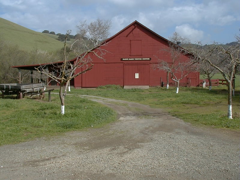 From the
parking area, look for a broad, palm-lined path heading south. Walk
down the path to the Visitor Center, a red barn (open weekends in
the summer). Here you can find a map and use the restrooms. When you're
ready to start hiking, begin at the undersigned junction just past
(south of) the barn. Take the second trail heading right. The
flat path passes through pretty groomed picnic areas and by the kite field.
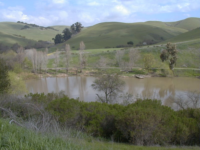
A path heads right at 0.3 mile, heading to the west side of Jordan Pond.
Turn right and cross over the spillway, then turn left.
From the
parking area, look for a broad, palm-lined path heading south. Walk
down the path to the Visitor Center, a red barn (open weekends in
the summer). Here you can find a map and use the restrooms. When you're
ready to start hiking, begin at the undersigned junction just past
(south of) the barn. Take the second trail heading right. The
flat path passes through pretty groomed picnic areas and by the kite field.
A path heads right at 0.3 mile, heading to the west side of Jordan Pond.
Turn right and cross over the spillway, then turn left.
Several benches in shady spots rim the
pond. On a hot day the temperature feels much cooler near the water,
where the breezes flutter leaves of cattails, willows, and other aquatic
plants. Blue elderberry trees put out distinctive blue berries in
autumn. After 0.35 mile, turn right at a signed junction
onto High Ridge Loop Trail.
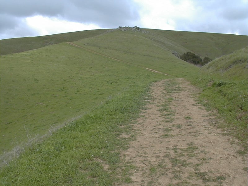
This broad multi-use trail climbs just
enough to give you a lovely view of Jordan Pond, and the hills north and
east. High Ridge Loop Trail sweeps easily uphill through grassland, with
some coast live oaks, buckeyes, fruit trees, and even some gooseberry
shrubs down slope to the left. A gate at 0.6 mile marks the intersection
of Ridge View Trail, from the northwest, and a hiking only trail from
the southeast. The hiking trail parallels High Ridge Loop Trail for a
while, then descends back to the valley floor
to join Dry Creek Trail. Continue on High Ridge Loop Trail,
where on a visit on a hot September day, the grasshoppers were jumping
all over the place and the air smelled like sage. In spring, you may see
some California poppies and fiddlenecks. The trail begins descending slightly.
Follow a spur trail that crests the hills, or stay on High Ridge Loop
Trail around the hill; both trails meet on the other side. The next
stretch of trail unfortunately features sounds and views of Mission Boulevard,
and then the backyards of some houses abutting the park. High Ridge
Loop T rail crosses Meyers Ranch Trail near the Tamarack entrance, at
a signed junction at 1.6 miles. Bear right and then left to continue
on High Ridge Loop Trail.
 Cows are prevalent in this
section of the park. Some giant oaks stand sentinel on the summit
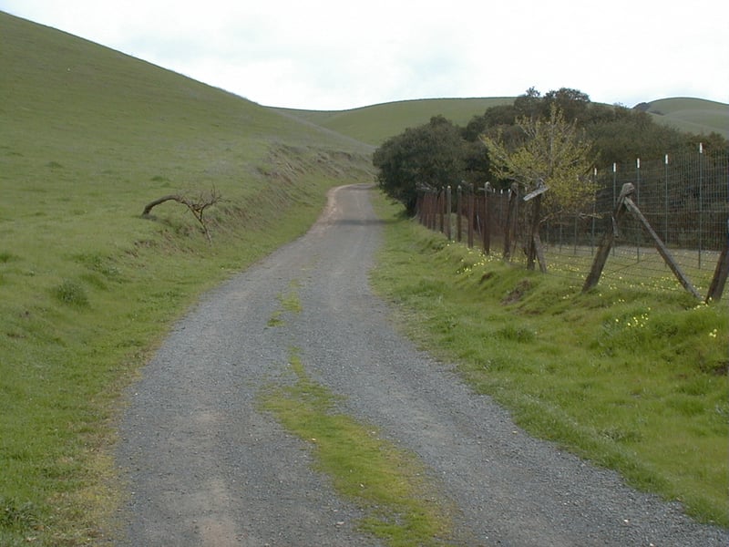
of a hill on the left side of the trail. An old orchard is fenced
on the right side, and the trees are a froth of flowers in late winter.
On a late winter hike here, I spotted three wild turkeys at the edge of
grassland, under the trees. At a signed junction near a small pond, at 2.1 miles, Tolman Peak Trail begins and continues to the east (the trail loops around its namesake peak near the park boundary). Turn
left here and head uphill on a wide trail that runs along a creek
bed.
Cows are prevalent in this
section of the park. Some giant oaks stand sentinel on the summit
of a hill on the left side of the trail. An old orchard is fenced
on the right side, and the trees are a froth of flowers in late winter.
On a late winter hike here, I spotted three wild turkeys at the edge of
grassland, under the trees. At a signed junction near a small pond, at 2.1 miles, Tolman Peak Trail begins and continues to the east (the trail loops around its namesake peak near the park boundary). Turn
left here and head uphill on a wide trail that runs along a creek
bed.
Although this part of High Ridge Loop Trail
climbs steadily, the trail is almost completely shaded by oak, buckeye,
maple, sycamore, and California bay trees. You may see snowberry's blossoms
in spring, and white berries in autumn. The wide trail gets muddy in winter.
Pioneer Trail (open to hikers and equestrians only) heads out from the
left side of the trail near a small pond at a signed intersection at 2.6
miles. (Option: to shorten your hike to about 4.6 miles, turn left on
Pioneer. The path climbs through woods, then emerges into grassland and
descends along a creek. You may notice a lot of kites and kite parts strung
up in the branches of trees. I was confused by this, until
I remembered the kite field down by the Visitor Center. Amazing how far
those escaped kites make it! Pioneer Trail ends at an unsigned junction
with Meyers Ranch Trail. Walk a few hundred feet to the left and at the
signed junction with Dry Creek Trail, turn right. Cross a narrow bridge
and meander along across Dry Creek on this peaceful and lush trail, where
common snowberries and wild roses are prevalent in the understory. The
trail turns to pavement and then ends at Jordan Pond. Stay to the
right around the pond, past the beginning of High Ridge Loop Trail, and
back to the parking area.) For the featured hike, continue straight
on High Ridge Loop Trail.
High Ridge Loop Trail continues to climb,
although it soon leaves the woods, taking a sharp turn right and passing
through sagebrush and poison oak on the steepest stretch of the trail.
The grade eases up at 2.9 miles, at an undersigned junction with F. D. 143 Trail. Bear left and remain on High Ridge Loop Trail.
Ascending through grassland, a few oaks and great swaths of poison oak dot the hillside. On clear days, you likely have views west across the bay to the Santa Cruz Mountains, as well as nice perspectives of the rest of Garin/Dry Creek, including Tolman Peak to the south. High
Ridge Loop Trail pushes on uphill, cresting at a signed junction at 3.4
 miles. A semi-loop path to Gossip Rock begins on the right. A nicely placed
bench provides the perfect spot for a rest break, although on a cool windy
day you probably won't want to linger. Continue on High Ridge Loop
Trail.
miles. A semi-loop path to Gossip Rock begins on the right. A nicely placed
bench provides the perfect spot for a rest break, although on a cool windy
day you probably won't want to linger. Continue on High Ridge Loop
Trail.
The trail bisects the burrows of an active
squirrel community. A pretty little pond nestles in the hills downslope
to the right, and a bit further down the trail another pond sits downhill
on the left. High Ridge Loop Trail nears the fenced park boundary, and
begins an easy descent. Buttercups and suncups may be glimpsed along the
trail in late winter, but the cows don't leave many flowers behind as
they graze along the ridgetops. At 4.4 miles, Meyers Ranch Trail heads
downhill to the left at a signed junction. Choosing Meyers Ranch will actually extend your hike a bit,
but it's an option. Continue straight on High Ridge Loop Trail.
As you descend, you'll have increasingly
lovely views of Garin Peak and the surrounding area that makes up the
northernmost section of the park. High Ridge Loop Trail passes through
a cattle gate, then meets Newt Pond Trail at a signed junction at 5.1
miles. You can continue on High Ridge Loop Trail (which ends back by the
Visitor Center), but on my last hike at Garin/Dry Creek, I decided to
explore Newt Pond Trail. Bear right onto Newt Pond Trail.
Cow paths make it tough to pick out narrow
Newt Pond Trail, which despite its size, is open to hikers, equestrians,
and cyclists. The trail abruptly turns right, slipping through grassland.
Switchbacks soften the descent. You may encounter cows on or around the
trail, which passes under some oaks and then seems to split. A rough path heads to the creek
on the left, and another continues straight. The whole area is scored
with cow paths, so I don't suppose it matters much which way you go, so
long as you pass through the creek at the obvious crossing. On the other
side, turn left onto multi-use Old Homestead Trail, at a junction
at 5.4 miles.
The flat wide trail soon meets up, at a
signed junction at 5.5 miles, with Vista Peak Loop Trail, on its way
to Garin Peak. Continue straight on Old Homestead Trail. You'll pass through
a cattle gate and meet the road to the campground; bear left. The trail
becomes a narrow paved road. Running along Dry Creek, Old Homestead Trail
is particularly lovely in winter when numerous fruit trees bloom. The
trail draws near to the Ranch Side picnic area, right across the maple
and sycamore-lined creek. At 5.8 miles, Old Homestead Trail ends at a
gate. Turn left, go around (or through) another gate, and you'll
be back in the parking lot.
Total distance: 5.8 miles
Last hiked: March 9, 2001
Previous visit: September 10, 1999