Pleasanton
Ridge is beloved and heavily used, but because there is only one main trailhead, at the southern edge of the park, the further you hike, the more solitude you'll find. On my first visit, I crossed
paths with joggers, dogwalkers, and cyclists for the first 2 miles, but
then encountered no one until I returned back to that 2-mile-from-the-trailhead
zone. Up on the ridgeline, near 1500 feet, it was just me and and the
wildflowers swaying in the wind.
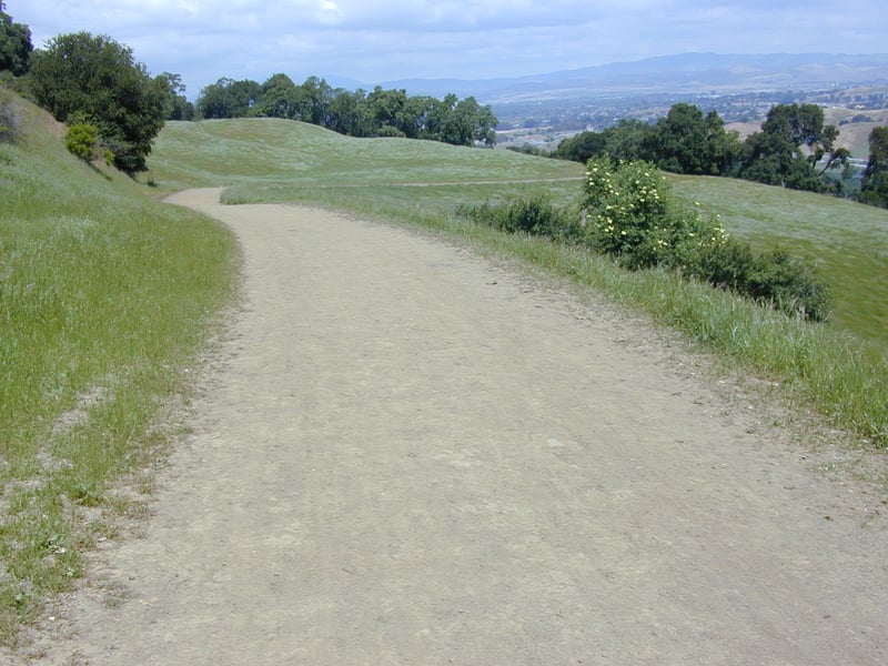
There are many loop options, but for a medium
or long hike Ridgeline Trail plays the prominent role. Ridgeline accesses
the far northern reaches of the park, Kilkare Canyon and Sinbad Creek.
A round trip hike to the edge of the park is more than 14 miles, with
some serious climbing on both legs of the journey. The shortest loop at
the park combines Oak Tree and Woodland
Trails, for a less than 2 mile stroll. Early spring is a great time to
 visit Pleasanton Ridge -- mid to late March is just about ideal for a
loop on Thermalito and Ridgeline Trails. Unlike some East Bay parks that
are grazed by cows, Pleasanton Ridge is quick to dry out after the winter
rains end. You'll probably find smooth, dry trails and green hillsides
even before the oaks have their fresh spring leaves. In summer it is often
HOT, and there's very little shade on most trails.
visit Pleasanton Ridge -- mid to late March is just about ideal for a
loop on Thermalito and Ridgeline Trails. Unlike some East Bay parks that
are grazed by cows, Pleasanton Ridge is quick to dry out after the winter
rains end. You'll probably find smooth, dry trails and green hillsides
even before the oaks have their fresh spring leaves. In summer it is often
HOT, and there's very little shade on most trails.
For the featured hike, start uphill on
Oak Tree Trail. As the trail winds steeply up an exposed hillside,
coast live oaks are the dominant tree, with poison oak, sticky monkeyflower,
coyote brush, and snowberry in the understory. Interstate 680 is audible,
but traffic noises decrease as you head up the broad multi-use trail.
At 0.15 mile, Woodland Trail sets out from a signed junction at a curve
in the trail. Turn left onto this path, open to hikers and equestrians only.
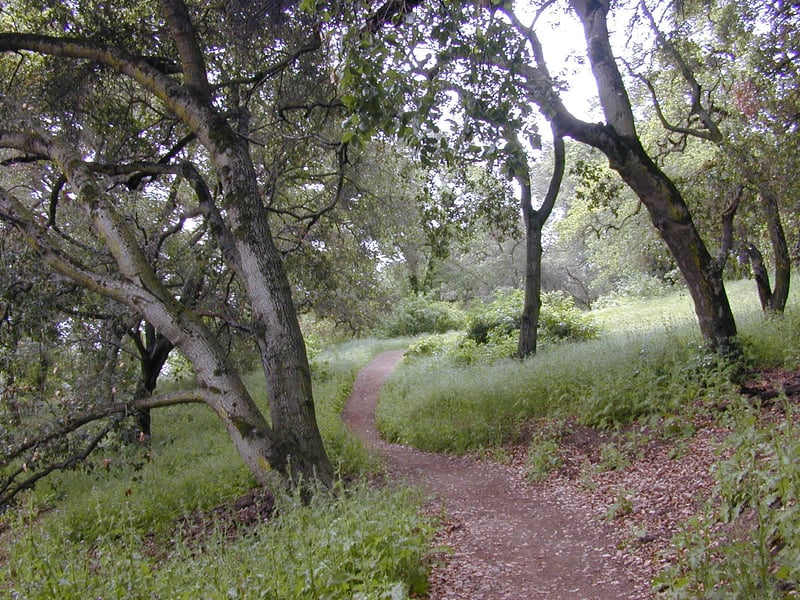
Climbing uphill at a moderate grade, Woodland
is dominated by coast live oaks. There's an astonishing amount of poison
oak growing alongside the trail, so don't stray off course. In the first
few weeks of spring, California buttercups add a dash of cheerful color.
Later, in early May you might see Chinese houses. Switchbacks break up
the climb (ignore any shortcuts). As the trees thin, the trail levels
out and sweeps into a meadow. A look over your shoulder reveals the bare
ridge on the east side of Interstate 680. At 0.6 mile, Woodland splits into
two evenly worn trails. The trail to the left cuts through a meadow, while
the trail to the right skirts the meadow. Stay to the right, as
the park district is attempting to restore the meadow. As Woodland Trail
continues an easy climb, it edges near Oak Tree Trail; a connector path
veers right at 0.8 mile, but stay on Woodland. The trail ducks under
some oaks and then ends at a junction with Oak Tree Trail at 1 mile. Continue straight through
 the cow gate to a large well-worn junction.
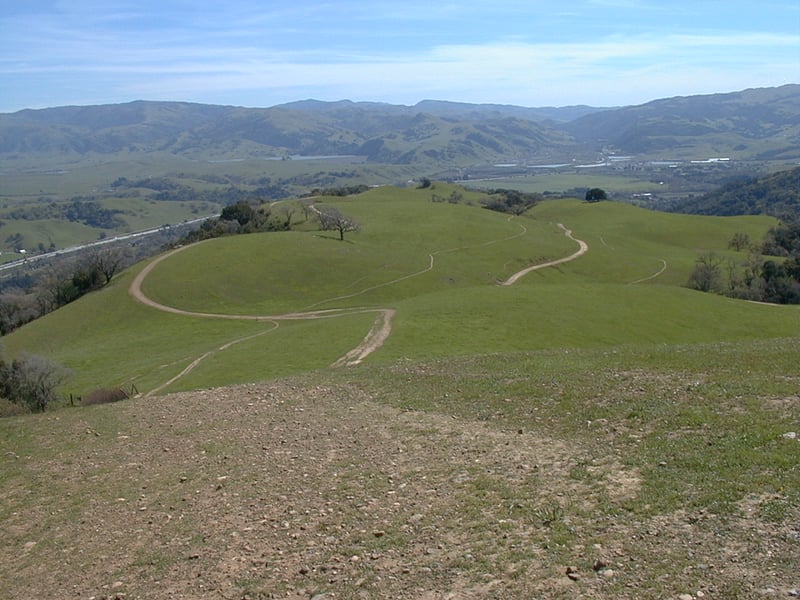
From here trails wander hither and yon.
Ridgeline Trail heads south (left). The chunky looking trail uphill to
the right is a shortcut. Straight, and then to the left, Oak Tree Trail
continues downhill along a corridor of poison oak and chaparral. Straight,
and then rightish, is the trail you want, Ridgeline. (If you have
a paper map this junction is marked as #5.) As Ridgeline Trail ascends
slightly, curving to the right around a hilltop, in early spring you may
see a few flowers in the grass, including blue-eyed grass and bluedicks.
Ahead, the trail splits in a Y, just before a cluster of trees. This
orchard, the first of several olive groves, was planted around 1900. The
Thermal Fruit Company grew cherries, almonds, prunes, and apricots
in the southern portion of the park until the early 1930's. None of those
trees survive, or a record of who planted the olive trees, but
the olive trees are sturdy, and many still bear fruit. At a signed junction
at about 1.3 miles, bear left onto the spur trail to Olive Grove Trail.
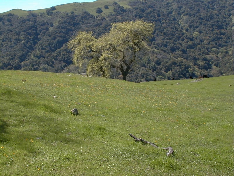
Sunol Ridge looms ahead, across Kilkare
Canyon. The olive trees provide a perfect picnic spot, especially for
a hiker pining for the Italian countryside. Just make sure the park's
cows haven't relieved themselves nearby! At about 1.35 miles, Olive Grove
Trail enters from the left at a signed junction. Continue straight,
and again, straight when Olive Grove breaks off to the right at a
signed junction at 1.45 miles. The broad path passes a pond, then joins
with Thermalito Trail at a signed junction at about 1.6 miles. Stay to
the left as a side trail breaks off on the right side. Thermalito edges
alongside a small, but steep canyon. Buckeyes are mixed in with valley
and coast live oaks. The trail crosses over the top of a creek, and a
 dry waterfall (at least in the spring) is overrun with poppies. On the
left side of the trail, valley oaks hold court over a pretty meadow. On
a March hike, the grass was filled with yellow johnny-jump-ups, a jovial
blossom in the violet family. When I visited again, in early May 2002,
squirrels scattered through the grass when a golden eagle soared overhead. Thermalito
ambles uphill past a small pond, and passes another meadow speckled with
flowers in spring. The first of the peaks on Ridgeline comes into view,
on the right. At a signed junction at 2.3 miles, a spur trail climbs
to meet Ridgeline. (This is an option, but the grade is steepest hiking
north on Ridgeline; the easier choice is to continue on Thermalito and
then hike south on Ridgeline.) Continue straight/left on Thermalito.
dry waterfall (at least in the spring) is overrun with poppies. On the
left side of the trail, valley oaks hold court over a pretty meadow. On
a March hike, the grass was filled with yellow johnny-jump-ups, a jovial
blossom in the violet family. When I visited again, in early May 2002,
squirrels scattered through the grass when a golden eagle soared overhead. Thermalito
ambles uphill past a small pond, and passes another meadow speckled with
flowers in spring. The first of the peaks on Ridgeline comes into view,
on the right. At a signed junction at 2.3 miles, a spur trail climbs
to meet Ridgeline. (This is an option, but the grade is steepest hiking
north on Ridgeline; the easier choice is to continue on Thermalito and
then hike south on Ridgeline.) Continue straight/left on Thermalito.
There are many side trails and shortcuts in this
part of the park, so try to stay on the main trail. Thermalito Trail begins
a light climb as the path curves around the base of a hill. Look for a
well-stocked woodpecker granary tree on the right side of the trail. At
2.7 miles, a spur trail to Ridgeline veers right at a signed junction.
Turn right and head uphill.
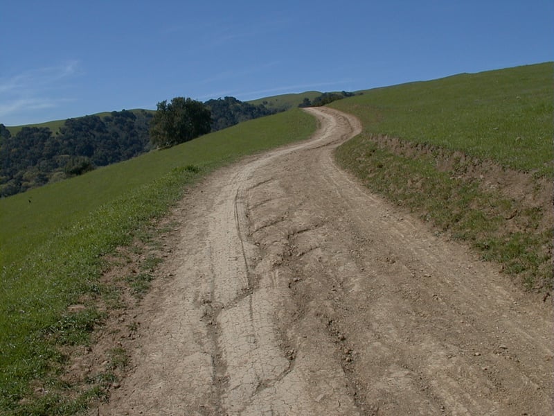
The grade is steep, but this section is short,
and at 2.85 miles, the spur tapers out and ends at a signed junction with
Ridgeline Trail. From here, you can turn right and descend back to the
trailhead, but for the best views, turn left and ascend the first crest.
It's a butt-crunching ascent on a multi-use trail (look out for bicycles)
and when you get to the top you may be dismayed that the trail dips a
bit and then climbs to another, taller peak, not visible from the previous
junction. Keep climbing to a second crest. This is the turnaround point for the featured
hike, at 3.05 miles. From here, at about 1530 feet, Mount Diablo looms
 across the populated valley, and the mountains of Sunol Regional Wilderness
and Mission Peak rise up to the south. On this often windy hilltop the
wildflowers grow close to the ground. Look for tiny blossoms of lupine,
redmaids, shooting stars (an early flower past its prime in spring), johnny-jump-ups,
and bluedicks. The trail continues north, bucking like a rodeo bull, cresting
and falling along the ridgeline, and if you'd like to extend your
hike 2 more miles, you can continue along Ridgeline for another mile to
Sinbad Creek Trail and then turn around. Ridgeline ends a bit past
that and any further hiking involves climbing down (and then back
out) Kilkare Canyon.
across the populated valley, and the mountains of Sunol Regional Wilderness
and Mission Peak rise up to the south. On this often windy hilltop the
wildflowers grow close to the ground. Look for tiny blossoms of lupine,
redmaids, shooting stars (an early flower past its prime in spring), johnny-jump-ups,
and bluedicks. The trail continues north, bucking like a rodeo bull, cresting
and falling along the ridgeline, and if you'd like to extend your
hike 2 more miles, you can continue along Ridgeline for another mile to
Sinbad Creek Trail and then turn around. Ridgeline ends a bit past
that and any further hiking involves climbing down (and then back
out) Kilkare Canyon.
Retrace your steps back to the junction
with the spur you climbed from Thermalito, then continue straight on
Ridgeline Trail. After a short, bearable climb, it's all downhill
from here. Ignore trails heading left at 3.6, 3.8, and 3.9 miles. Continue downhill on Ridgeline. The
trail ambles along a barbed wire fence tangled with poison oak, California
sagebrush, and sticky monkeyflower. Olive trees stand to the right and
left. A picnic table and water fountain are welcome at a sunny spot on
the side of the trail. You'll reach junction 5 again
at 4.6 miles, where the two legs of Ridgeline meet. Turn left and retrace your steps
back to the junction of Oak Tree and Woodland Trails. For
a change of pace, descend, to the left, on Oak Tree Trail.
Traffic noises become noticeable and then increasingly
loud as you hike downhill. A few large imposing sycamore trees step aside
to let you pass. At 5.2 miles, the dead-end Sycamore Grove Trail sets
out on the left side of the trail. Continue straight on Oak Tree.
You'll pass the previously encountered junction with Woodland Trail at
5.7 miles. Retrace your steps on Oak Tree Trail back to the trailhead.
Total distance: 5.8 miles
Last hiked: Wednesday, May
1, 2002