4.8 mile loop in the hills around Phoenix Lake, on the outskirts of Kentfield.
Distance, category, and difficulty:
This 4.8 mile loop hike is easy, with about 990 feet in elevation change.
Exposure:
Mostly exposed.
Trail traffic:
Moderate-heavy.
Trail surfaces:
Dirt fire roads and trails.
Hiking time:
2 hours.
Season:
Good anytime, best in late winter.
Getting there:
From US 101 in Marin County, exit San Anselmo/Sir Francis Drake. Drive west on Sir Francis Drake about 3.5 miles to the intersection with Lagunitas Road (by the Marin Art and Garden Center), turn left onto Lagunitas and drive about 1 mile to the parking lot at the end of the road.
GPS coordinates* for trailhead:
Latitude
Longitude
(* based on Google Earth data, shown as degrees, minutes, seconds)
Gas, food, and lodging:
Gas, pay phones, stores, and restaurants about 2 miles away, near the junction of College and Sir Francis Drake in Ross. No camping.
Trailhead details:
Parking for about 24 vehicles, with a few designated handicapped spots -- parking spaces get snatched up fast so arrive early or be prepared to wait. No parking or entrance fees. No paper maps available. Two portable toilets in lot (one wheelchair accessible), and two more pit toilets near Phoenix Lake. Access to wheelchairs/strollers is unobstructed. Drinking water on Phoenix Lake Trail, near the junction with Worn Springs Trail. Lot is open from sunrise to sunset. There is no direct public transportation to the park, but Golden Gate Transit's #20 bus services Sir Francis Drake, and you could walk about 2 miles to the trailhead.
Rules:
Most trails are multi-use. Some restrict bikes, and a few are hiking only. Dogs are permitted on leash in water district lands, but not in the state park.
The Official Story:
MMWD's Sky Oaks Ranger Station at 415-945-1181.
MMWD recreation page
Map/book choices:
• Trail map from MMWD (pdf)
• A Rambler's Guide to the Trails of Mt. Tamalpais and the Marin Headlands, map from Pease Press (order from Pease Press) is useful.
this map from Amazon.com).
• Mount Tam Trail Map, published by Tom Harrison Maps (order from Tom Harrison Maps). Comparable to the Olmsted map.
• The map (with accompanying text) in Barry Spitz's Tamalpais Trails (order this book from Amazon.com) is helpful.
• Hiking Marin, by Don and Kay Martin has good maps and area descriptions (order this book from Amazon.com).
Go to Bay Area Hiker Home page
The
Marin Municipal Water District manages all
the land on the northeastern slope of Mount Tamalpais. They created 5
reservoirs in this area (Phoenix Lake was built in 1905) to supply water
to the people of Marin County, and at the same time preserved a large
hunk of land for rugged recreation use.
Unlike the State Park portion
of Tam, the trailheads near the lakes are easy to get to. Phoenix Lake,
which is close to Ross, provides convenient access and an abundance of
hike possibilities. For a short and easy walk around Phoenix Lake, hike
uphill to the lake and then combine Bill Williams Trail, Gertrude Orr
Trail, and Phoenix Lake Trail, a stroll of about 2.7 miles. If you've
got energy to burn and strong legs, you can impress your friends by hiking
all the way to the top of Tam, via Eldridge Grade. It's an over 12.5 miles
 round trip, and an elevation gain (and than loss) of 2,114 feet (more
if you continue to East Peak). Most visitors seem to use the trails
near Phoenix Lake for exercise and relaxing walking with kids and/or dogs. Arm yourself with a map or two, and explore the tremendous
variety of trails.
round trip, and an elevation gain (and than loss) of 2,114 feet (more
if you continue to East Peak). Most visitors seem to use the trails
near Phoenix Lake for exercise and relaxing walking with kids and/or dogs. Arm yourself with a map or two, and explore the tremendous
variety of trails.
For the featured hike, walk through the
gate and uphill on the wide fire road. In the winter, the water rushing
down from the spillway, and then in the creek, is a torrential accompaniment.
Look downslope to the left for a quaint stone shelter -- with moss and
ferns growing on the roof, it's straight out of a fairy tale (the building,
and surrounding small park, as well as the parking lot, are managed by
the town of Ross). California bays, oaks, buckeyes, and madrones line
the sides of the gently graded road. At 0.3 mile, the road passes by
the spillway (a great artificial waterfall in the winter) and then crests
near the shores of Phoenix Lake. There are a couple benches on the shore here, but if you want quiet contemplation, there are
additional benches further up the trail that are more remote.
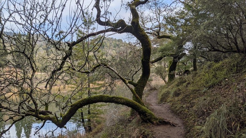
Continue walking straight, on the right
(north) shore of the lake, on Phoenix Lake Trail (signed to Lake
Lagunitas). To the right of the trail there's a lovely house with a killer
view (a ranger residence). A dock in the middle of the lake
is usually populated with ducks, grebes, turtles, and an occasional heron, egret, or cormorant.
As the trail winds levelly around the lake, at 0.35 mile, Worn Springs
Trail sets out on the right side of the trail from a signed junction. (For
a longer, more strenuous hike than this featured walk, head uphill on
Worn Springs, enjoy the view at the top of Bald Hill, then
descend to the junction with Yolanda, turn left and pick up the featured
hike at the Six Points Junction.) Continue straight on Phoenix Lake
Trail. At 0.6 mile, just before the trail winds around the log cabin
(the Olmsted map calls this the Hyppolyte Site), Yolanda Trail begins
on the right side of the trail at a signed junction. Turn right onto Yolanda Trail.
 Yolanda, open to hikers and equestrians only, initially climbs
through California bay, coast live oak, and madrone, alongside a seasonal creekbed. As early as late January,
look for some wildflowers in the grassy understory, including white milkmaids
and purple hound's tongue. Invasive broom has established a stronghold
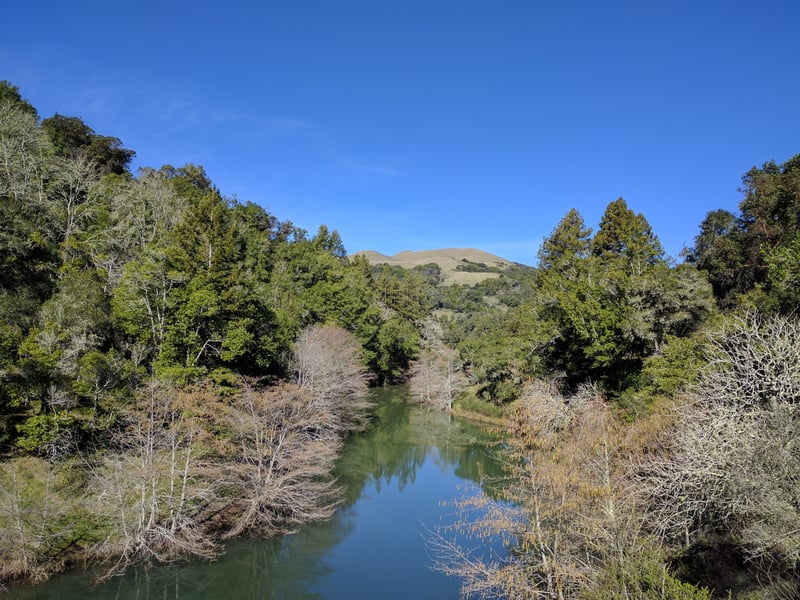
along the trail. Yolanda takes a sharp turn and climbs to the north. The
trees thin slightly and a look back over your shoulder showcases a view
up to the summit of Mount Tam. The trail maneuvers around a tangle of
tree roots beneath some madrones at 0.8 mile, where a spur trail heads back south
to the right; continue straight/left on Yolanda.
Yolanda, open to hikers and equestrians only, initially climbs
through California bay, coast live oak, and madrone, alongside a seasonal creekbed. As early as late January,
look for some wildflowers in the grassy understory, including white milkmaids
and purple hound's tongue. Invasive broom has established a stronghold
along the trail. Yolanda takes a sharp turn and climbs to the north. The
trees thin slightly and a look back over your shoulder showcases a view
up to the summit of Mount Tam. The trail maneuvers around a tangle of
tree roots beneath some madrones at 0.8 mile, where a spur trail heads back south
to the right; continue straight/left on Yolanda.
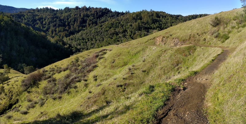
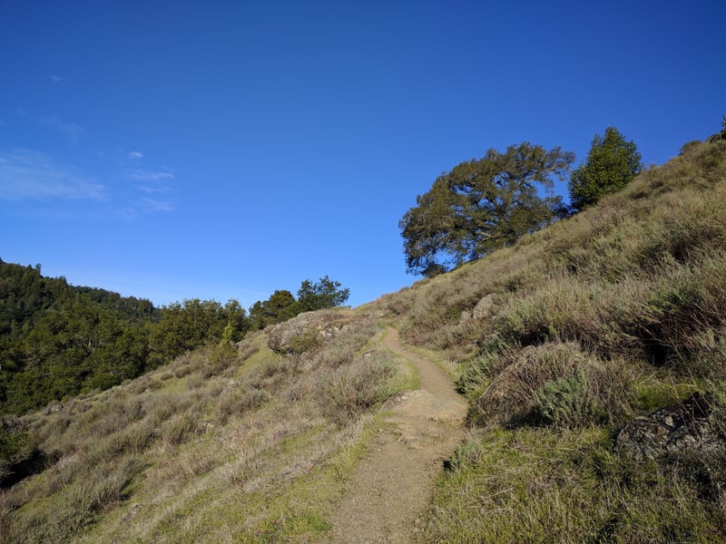
Yolanda enters the shade of some California
bays and madrones, then crests at a saddle and emerges into chaparral.
Views open up to Bald Hill. The path is narrow and edges across the hillside,
through chamise, toyon, sticky monkeyflower, and California sagebrush.
After heavy rains, Yolanda Trail crosses over (and through) many seasonal
streams headed downhill. The sound of water rushing,
and the sight of the many waterfalls, makes for a soothing walk. The trail
is often damp in spots, and you may get your feet wet walking through
the streams that cross the trail. Yolanda is a perennial favorite for
wildflowers; in late winter you might see the last of the shooting stars,
plus bluedicks, larkspurs, popcorn flowers, and California poppies. In
spring and summer delightful green knolls on the side of the trail are
perfect for a sunny snooze, bird watching, or gazing to the profile of
Mt. Tam. Look for the formation known as "Lion Rock" looming
off the right side of the hillside. The trail gets heavy use from joggers,
so try to keep out of their way. As Yolanda Trail wanders from chaparral
into damp mini-canyons, California bays, oaks, and madrones create some
shade. A dead-end path to the west, on the left side of the trail, visits
a grassy plateau studded with oak trees, a great picnic spot. Yolanda Trail
enters a shaded stretch, where two waterfalls join together on the right
 side of the trail and cross over the path. Soon after, at 1.9 miles,
you'll enter the junction known as Six Points.
side of the trail and cross over the path. Soon after, at 1.9 miles,
you'll enter the junction known as Six Points.
The first trail to the right (counterclockwise)
is a continuation of the Yolanda Trail. The next trail counterclockwise
is Six Points Trail (it's unsigned in the middle of the junction; if you're
walking into the junction on Hidden Meadow Trail it's signed to "Oak
Tree Junction"), then comes Bald Hill Trail, and finally Hidden Meadow
Trail. Turn left onto Hidden Meadow Trail,
a path open to hikers and equestrians only (sometimes seasonally closed
to horses), that angles downslope from a ridge through lumpy grassland.
In winter, some small streams cascade downhill over the trail,
and then through the meadow. Much too soon for me, Hidden Meadow Trail
struggles through an invasive patch of broom and leaves the grassland
behind. After trailing beneath some California bays, the path reemerges
into the grassland to offer great views back uphill toward Bald Hill.
Then it's another portion of trail choked with broom, and a fence-protected
series of switchbacks down to a creek crossing. Finally, you reach Hidden
Meadow itself, an unexpected gorgeous lowland grassy area dotted with
oaks and moss-covered buckeyes. In spring, clouds of butterflies drift
through the meadow; look for swallowtails and checkerspots. The stream
keeps you company on the left side of the trail. In 2000, the water district
installed two bridges (one at the base of the switchbacks and the other at a second creek crossing)
and rerouted Hidden Meadow near the junction with Shaver Grade. You may hear voices
drifting down from the nearby and popular fire road as you pass through
some young redwoods and draw closer to a junction at 2.45 miles. Hidden
Meadow ends at Shaver Grade Trail. Turn left (the signpost points
toward Ross).
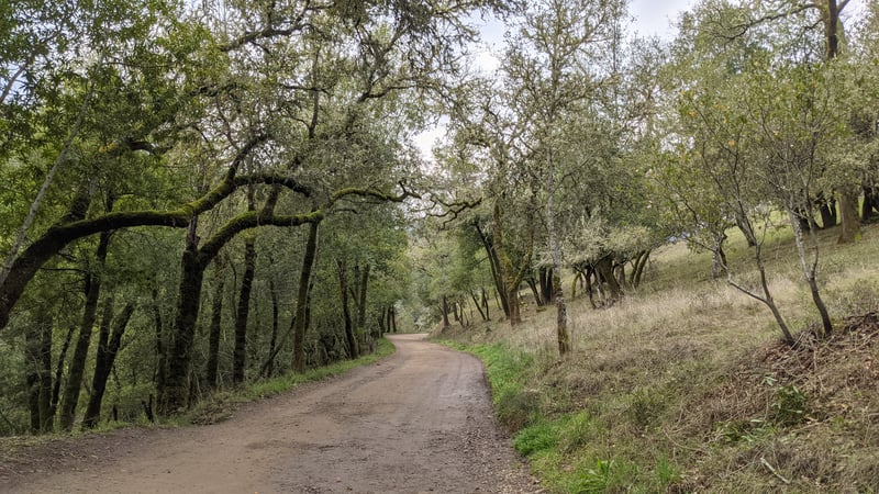
Expect heavy bicycle traffic on Shaver
Grade, as it's a well-graded (hence the name) fire road that climbs from
 Phoenix Lake towards Bon Tempe Lake. The path is shaded by a few redwoods
and oaks, with California bays dominant, and a stream following along
to the left. At 2.9 miles, Shaver Grade ends at Phoenix Junction, another
multi-trail extravaganza. Counterclockwise, the first trail to your
right is Fish Gulch Trail, then there's the wide Fish Grade, followed
by Eldridge Grade, and then Phoenix Lake Trail. Eldridge, another popular
cycling route, climbs all the way to 2,244 feet, ending between Tam's
Middle and East Peaks. Continue on the first trail to your left, Phoenix
Lake Trail, and continue a level walk through the trees.
Phoenix Lake towards Bon Tempe Lake. The path is shaded by a few redwoods
and oaks, with California bays dominant, and a stream following along
to the left. At 2.9 miles, Shaver Grade ends at Phoenix Junction, another
multi-trail extravaganza. Counterclockwise, the first trail to your
right is Fish Gulch Trail, then there's the wide Fish Grade, followed
by Eldridge Grade, and then Phoenix Lake Trail. Eldridge, another popular
cycling route, climbs all the way to 2,244 feet, ending between Tam's
Middle and East Peaks. Continue on the first trail to your left, Phoenix
Lake Trail, and continue a level walk through the trees.
Just a few steps past the junction, at
2.93 miles, look for a small trail on the right side, marked by a "no
bicycles" sign. Turn onto this narrow path, Gertrude Ord Trail. Not much wider than one person, the trail pads
softly over redwood needles alongside Phoenix Creek. When you get to
the bridge, at 3 miles, turn right and cross the creek. Gertrude Orr Trail runs along Phoenix Creek,
which soon empties into the lake. Redwoods are common in the fingerlike extensions of the lake,
accompanying ferns, hazelnut, creambush, and trilliums and milkmaids that bloom in early spring.
In slightly sunnier stretches uphill from the shoreline, you might notice madrone, California bay,
coast live oak, big-leaf maple, and black oak. The trail alternates level sections with some undulating
areas where steps keep the path stable. Just past an area heavily colonized by tanoak, the trail rises,
drops on a graceful flight of curving stairs, and then ends at 4 miles.
Bill Williams Trail heads deeper into the mountain, to the right. Turn left onto a fire road.
This broad fire road ascends at a barely noticeable rate, along the eastern shore of Phoenix Lake.
On the right, look for a short but pretty waterfall, active during the rainy season with redwood,
big-leaf maple, madrone, and California bay lining the trail. At 4.1 miles, Harry Allen Trail sets off on the right,
but continue straight on the fire road. Blossoms on broom and mananita shrubs through here draw hoards of bees in early spring,
filling the air with a drowsy buzzing sound. Look for good displays of red ribbon clarkia on the right in late spring.
A bench a short distance off the trail to the left is a good spot to enjoy views stretching across the lake to the crest of Bald Hill.
The fire road levels out above the dam, and a path leading back to Lagunitas Road departs on the right at 4.5 miles. Continue straight.
The shallows off to the left of the trail host many somewhat-tame ducks that often waddle over to quack for snacks along the shoreline.
At 4.6 miles, you’ll return to a familiar junction, above the spillway. Turn right and walk back downhill on the fire road.
Total distance: 4.8 miles
Last hiked: January 27, 2017
Previous visits: February 1, 2012; January 3, 2008; May 26, 2004; March 24, 2003; and March 8, 2001