There
are other more scenic, peaceful, and user-friendly shoreline parks and preserves on San Francisco Bay, but
Bair Island, like the underdog in a football game, is a place you'll find
yourself rooting for. Purchased by Peninsula Open Space Trust and now
under the stewardship of the Don Edward San Francisco Bay Wildlife Refuge,
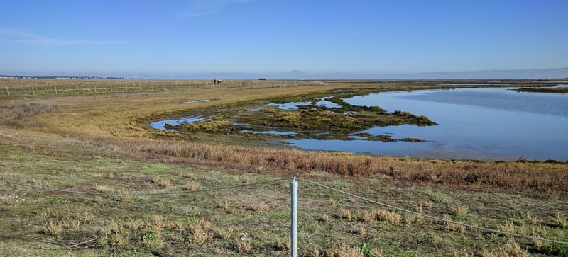
Bair Island is being restored to tidal marsh, and supports wildlife
including migrating waterfowl, shorebirds, and at least two endangered
species, the clapper rail, and salt marsh harvest mouse. Visitors
walking here may see a variety of birds and animals -- bring your binoculars.
The land was historically used to graze cattle and for salt harvesting. Redwood City residents
 rejected development plans in 1982, and after a long struggle, P.O.S.T.
acquired Bair Island in 1999. As the property is restored, vegetation
and animal life will become more varied and healthy, so it'll be interesting
to watch the transformation of the 3,200 acre preserve.
rejected development plans in 1982, and after a long struggle, P.O.S.T.
acquired Bair Island in 1999. As the property is restored, vegetation
and animal life will become more varied and healthy, so it'll be interesting
to watch the transformation of the 3,200 acre preserve.
Bair Island is comprised of 3 islands separated
by sloughs. Only the western island is publicly accessible, and unfortunately,
it is directly adjacent to US 101. Access is easy from nearby peninsula
towns, making Bair Island a convenient destination for jogging or daily strolls.
It takes a bit of selective hearing to ignore the persistent highway traffic
noise, as well as the drone of airplanes landing at San Carlos Airport,
just to the north of Bair Island.
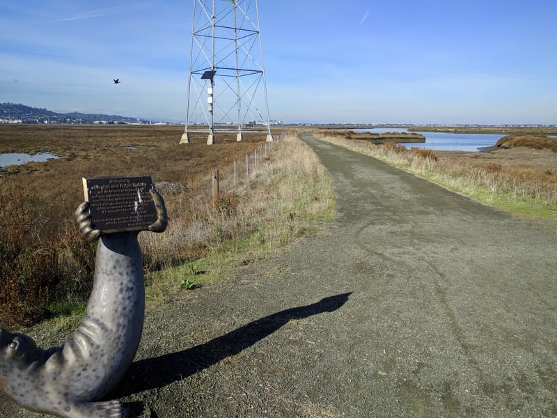
Start from the parking lot on Sea Anchor Drive. Cross Bair Island Road and walk on the sidewalk toward the bridge, to the right. Once through the gate and across the bridge, you'll arrive at an information exhibit and junction. Turn left.
The flat wide trail heads north. US 101 is visible and audible. Pickleweed is common along the trail, and you might also see curly dock, New Zealand spinach, coyote brush, gumplant, and sea lavender. Look for wading birds picking their way through the mudflats, including stilts, godwits, curlews, and avocets. Ducks are also common in deeper water -- I've seen Northern shovelers and Northern pintails. Closer to the trail crowned sparrows and phoebes flit about. On a July hike I saw a vulture sitting a few yards from the highway, snacking at some poor creature thankfully obscured by the surrounding vegetation. The trail turns east and traffic noise is dampened, but never recedes completely. Respect the signs prohibiting exploration of the area off trail (particularly to the left, which abuts the airport). On a November hike I noticed animal prints on the damp trail surface. These small cat-like prints were most likely made by a gray fox. At 1.5 miles you'll reach the end of the trail and an observation platform. Nice views stretch east across the bay to Mount Diablo and the East Bay hills. When ready, retrace your steps back to the information exhibit near the bridge.
Continue, to the left, toward the second observation platform. Smith Slough, to the right, is
deep enough for leopard sharks and rays, keep an eye out! At 3.3 miles this spur ends at an observation platform. When ready, retrace your steps back to the information exhibit, then the trailhead.
Total distance: about 3.6 miles
Last hiked: November 28, 2017
Previous visit: July 20, 2001
Go to Bay Area Hiker Home page