Some
people just can't get beyond the name. "Memorial Park? Sounds
like a cemetery," was a comment from a friend when I mentioned
my trip to San Mateo County's small park somewhat overshadowed by
the larger neighboring Pescadero Creek and Portola parks. Memorial Park's
name seems a little strange, but consider that the land, acquired by the
county in 1924, was named for the men of San Mateo County who were killed
in World War I. Somehow the sentiment seems appropriate for a park huddled
under redwoods; these reverent old trees encourage contemplation. Pets,
horses, and bikes are not permitted in the park, and that lends to
the tranquil atmosphere.
Upon arrival at Memorial, you may get the
feeling that day hikers, while welcome, aren't the park's bread and butter.
 The main attractions at this park nestled back in the forest on the shores
of Pescadero Creek, are camping and picnicking. On my first visit I drove
around for a while wondering where to park; all the roads seem to lead
to campsites. I finally asked a ranger and was directed to the Tanoak
Picnic Area, where I parked in the deserted lot.
The main attractions at this park nestled back in the forest on the shores
of Pescadero Creek, are camping and picnicking. On my first visit I drove
around for a while wondering where to park; all the roads seem to lead
to campsites. I finally asked a ranger and was directed to the Tanoak
Picnic Area, where I parked in the deserted lot.
Memorial lends itself to a getaway weekend
of day hiking and camping. From the park you can hike into Pescadero
Creek County Park, or further yet, to Portola State Park, or even into
Butano State Park. After a day of hiking, you could return to the park,
take a swim in the creek, then sleep peacefully under the redwoods.
Inside Memorial there are a few trails that wind
through and around the campgrounds and picnic areas on the south
side of Pescadero Road, but better hiking can be found on the north side
of the road. Pomponio Trail, Mt. Ellen Nature Trail, and Mt. Ellen
Summit Trail connect to create a few possible loop hikes. The longest
loop (the featured hike) is an easy 3 mile jaunt, but this is definitely
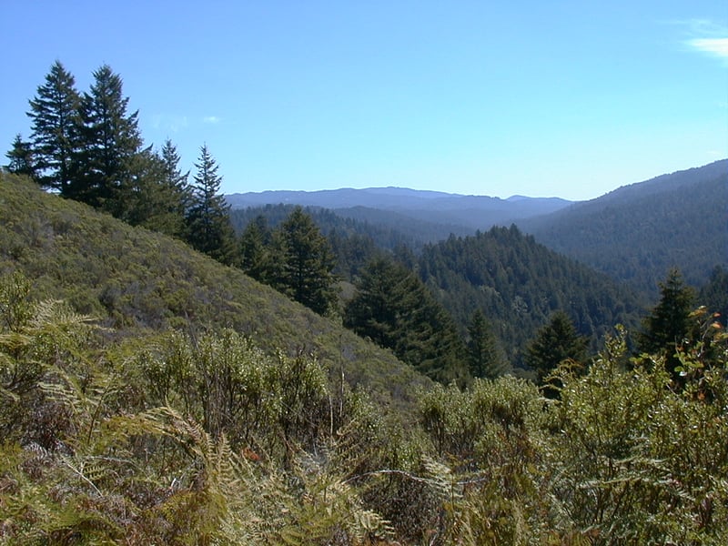
not a case where length dictates quality. Amazing views, redwoods, chaparral,
and a riparian corridor comprise this quiet trek on hiking-only trails.
If you'd like to take the self-guided nature trail, stop at the entrance
kiosk to borrow a pamphlet.
For the featured hike, start at the Tanoak
Picnic Area and walk back along the park road about 0.15 mile, passing the entry kiosk, to Pescadero
Road. Aim for the signed trail across the street to the left and carefully
cross the road. Begin on Mt. Ellen Loop Trails, which are open to
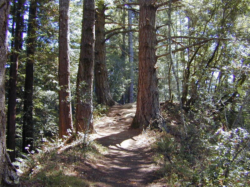
hikers only. California bay, coast live oak, tanoak, and redwood permit
little light to filter down to the forest floor, and huckleberry and hazelnut
are abundant. During a nicely-graded easy climb traffic noise from Pescadero
 Road is audible. After 0.25 mile, the trail splits at a signed junction.
Bear left, following the signs for Pomponio Trail, on Trillium Nature Trail.
Road is audible. After 0.25 mile, the trail splits at a signed junction.
Bear left, following the signs for Pomponio Trail, on Trillium Nature Trail.
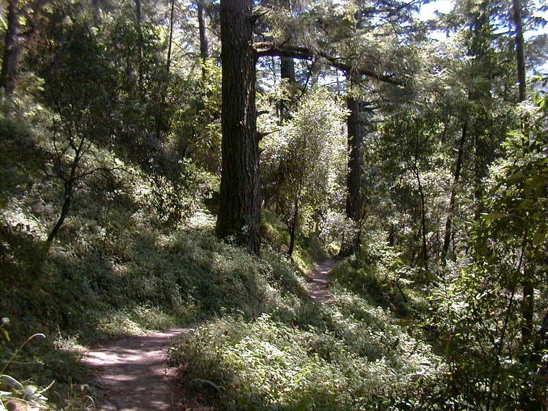
The narrow path ascends slightly through the woods. Look for redwood sorrel, yerba buena,
starflower, and trillium in the spring. At 0.4 mile, the trail splits at a signed junction. Take
the trail to the left, downhill, toward Pomponio Trail.
Fallen trees litter the forest floor. In autumn
a bigleaf maple is conspicuous. You'll pass a signpost confirming you're
headed to Pomponio Trail, and then at 0.5 mile, you'll reach an undersigned
junction. A fire road heads back to Pescadero Road to the left. Turn
right onto Pomponio Trail.
(Note: a hiker reported that as of May 2020 this trail was badly overgrown, with poison oak and stinging nettles crowding the trail.)The wide, hiking-only trail starts out under
redwoods, along a creek. A sunny little clearing along the trail is overgrown
with blackberries and nettles. As Pomponio Trail starts a slight climb,
look for dogwood, thimbleberry, hazelnut, and creambush. Poison oak is
common. Redwoods are left behind and in their absence you'll have a clear
view uphill to the right, of the chaparral and Douglas fir-dotted ridgeline.
The trail makes a turn to the left and begins a serious (although still
easy) climb. A series of long, broad switchbacks make the ascent a breeze.
Along the way, fallen bigleaf maple leaves add color and crunch to a hike
in autumn, and ferns create a lush feel. You may see gooseberry, currant,
coast live oak, California bay, huckleberry, and hazelnut. Forget-me-not
blooms are abundant from late winter through spring. Huge old Douglas
firs hold court on the sides of the trail. As the fire road narrows, a
fence to the left marks the park boundary, and Pomponio Trail steps out
of the shade and into sunny chaparral. Coyote brush, ceanothus, California
coffeeberry, creambush, bush monkeyflower, sagebrush, and poison oak are
common. Views open up to the south. The path is slight and ascends almost
 imperceptibly. A rest bench on the left makes a great rest or lunch spot.
A slump in the hillside has left a few feet of the trail lumpy and unstable.
You might see California fuchsia and coyote mint blooming in late summer.
Douglas firs edge into the chaparral, and the trail starts a subtle downhill
tack. Pomponio Trail ducks beneath a few coast live oaks draped with lace
lichen, then cuts through the chaparral one last time before returning
to tree cover. After a few switchbacks and a very short climb, the trail
drops down to a signed junction at 2.5 miles. You can cut this hike short
by veering right and returning on the Mt. Ellen Nature Trail, but
for the featured hike bear left onto Mt. Ellen Summit Trail.
imperceptibly. A rest bench on the left makes a great rest or lunch spot.
A slump in the hillside has left a few feet of the trail lumpy and unstable.
You might see California fuchsia and coyote mint blooming in late summer.
Douglas firs edge into the chaparral, and the trail starts a subtle downhill
tack. Pomponio Trail ducks beneath a few coast live oaks draped with lace
lichen, then cuts through the chaparral one last time before returning
to tree cover. After a few switchbacks and a very short climb, the trail
drops down to a signed junction at 2.5 miles. You can cut this hike short
by veering right and returning on the Mt. Ellen Nature Trail, but
for the featured hike bear left onto Mt. Ellen Summit Trail.
A few short stiff switchbacks sweep uphill
to the narrow ridge line. A segment of fence seems out of place here, but
if you carefully peak over the side, you'll notice an alarming dropoff.
Partial views to the north are mostly blocked by Douglas firs. Narrow
Mt. Ellen Summit Trail, open to hikers only, picks its way along the ridge.
Look for nuts on hazelnut shrubs in August, and in autumn, red berries
from toyon and honeysuckle brighten the Douglas fir and coast live oak
woods. The summit is not signed, but it is marked, in a way, by an exposed
large flat, sandy rock. Mt. Ellen Summit Trail starts a descent, with
switchbacks keeping the grade moderate. Fallen needles on the path mark
the reemergence of redwoods, and they are accompanied by California bays
and lush forest vegetation, with lots of hazelnut and blackberry brambles.
At 3 miles, stay to the left as Mt. Ellen Nature Trail heads
right at a signed junction.
The trail continues downhill. You might notice
a little bunch of buckeye trees, somewhat out of place in a redwood forest.
At 3.2 miles, you'll reach a previously encountered junction with the
other end of Trillium Nature Trail. Turn left and retrace your steps
back to the trailhead.
Total distance: 3.5 miles (includes the out-and-back walk from the parking area)
Last hiked: September 18, 2002
Previous visit: August 28, 2000