Pulgas
is a small, well-managed preserve with a large off-leash dog area where dogs can run through the poison oak and brush
to their hearts' content. If
you don't want to hike with dogs about, go across the canyon to Edgewood Park, where dogs
are not permitted. However, if you aren't bothered by the occasional dog
barking and charging down the trail at you, or if you are a dog owner,
give this preserve a shot.
The 293 acres that now comprise Pulgas were
formerly a tuberculosis sanitarium owned by the City of San Francisco.
MROSD purchased the land in 1983. Buildings were demolished in 1985, and
 most of the non-native plants have been removed, but there are still some
old walls and steps off Hassler Trail.
most of the non-native plants have been removed, but there are still some
old walls and steps off Hassler Trail.
In 2006 MROSD added a new parking lot and
two trails to the existing small trail network. A third route, Dusky-footed
Woodrat Trail, opened
in 2007. Dick Bishop Trail (formerly named Sagebrush Trail) begins up
on the ridge, and connects the end of Polly Geraci Trail with Blue Oak
Trail, avoiding the off-leash dog area. A short (as far as I know, unnamed)
path departs from the parking lot and connects to Cordilleras Trail, so
hikers no longer have to walk along Edmonds Road to connect a loop.
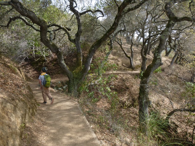
Begin from the edge of the parking lot,
and follow the signed trail toward Cordilleras Trail. The path
accompanies a string of power lines to the left, as it traverses a gently
sloping hillside. Coast live oaks, California bays, and buckeyes provide
shade. The property on the right is a substance abuse treatment center
-- stay on the trail here and keep it quiet. After some easy undulating,
the trail bends right, passes through a narrow tree-dotted meadow, crosses
a road, and meets Cordilleras Trail at a T junction at 0.14 mile. Turn left.
The trail cuts through private land, so
stay on the trail (don't walk on the road). Not too much to look at here,
just abundant poison oak shrubs, annoying non-native broom plants, and some
oaks and acacias overhead. You might see a few Ithuriel's spear and
 blue-eyed grass in spring. After 0.4 mile, at a signed junction, Cordilleras
Trail continues uphill, while a gated trail heads under the trees to the
right. (You can continue on the paved Cordilleras Trail to create
a shorter, 1.3 mile hike.) Turn right. After a few feet, at 0.45
mile, Polly Geraci Trail begins on the left at a signed junction.
The dead-end trail continuing straight is suitable for wheelchairs. Turn
left.
blue-eyed grass in spring. After 0.4 mile, at a signed junction, Cordilleras
Trail continues uphill, while a gated trail heads under the trees to the
right. (You can continue on the paved Cordilleras Trail to create
a shorter, 1.3 mile hike.) Turn right. After a few feet, at 0.45
mile, Polly Geraci Trail begins on the left at a signed junction.
The dead-end trail continuing straight is suitable for wheelchairs. Turn
left.
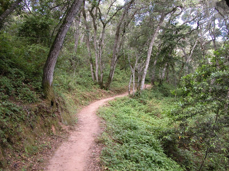
The Trail Center built this segment,
and it's a lovely hiking-only, gently-climbing trail that is
quiet and shady. In spring, look for mission bells, starflower, woodland
star, mule ear sunflower, milkmaids, columbine, hound's tongue, giant
trillium, Indian warrior, and fetid adder's tongue in bloom. Deer are
common, especially on the eastern side of this canyon. On the way uphill,
at 0.5 mile, Dusky-footed Woodrat Trail heads off to the right, taking hikers on a
long tour through the preserve's northern area. Continue straight on
Polly Geraci Trail.
Switchbacks ascend under buckeye, coast live
oak, madrone, and California bay trees. In the understory, gooseberries,
snowberries, and honeysuckle nestle among the ferns. Traffic noise from 280 infiltrates solitude as you climb. The foliage gradually shifts to chaparral near a
bench, where a small snip of the highway is visible,
as well as some large newer homes on the crest across the canyon to the
northeast. This section of chaparral is lovely, with tall chamise
 shrubs and manzanitas, giving the trail a tunnel feel. Spring flowers
include zigadene, bluewitch nightshade, and sticky monkeyflower. Elderberry,
yerba santa, ceanothus, pitcher sage, and toyon are also present. The
trail becomes sandy, and if you look across the canyon, you can see more
chaparral-coated rocky hills with small sandstone formations (unfortunately,
those hills are not part of the preserve). At 1.47 miles, the trail ends
at a signed junction with Hassler Trail -- Dick Bishop Trail begins
immediately across from the junction. Hassler to the right ascends to
run along a CalTrans vista point (fenced) -- the other end of Dusky-footed
Woodrat Trail connects to Hassler there. To the left, Hassler descends
to the off-leash dog area. Continue straight on Dick Bishop Trail.
shrubs and manzanitas, giving the trail a tunnel feel. Spring flowers
include zigadene, bluewitch nightshade, and sticky monkeyflower. Elderberry,
yerba santa, ceanothus, pitcher sage, and toyon are also present. The
trail becomes sandy, and if you look across the canyon, you can see more
chaparral-coated rocky hills with small sandstone formations (unfortunately,
those hills are not part of the preserve). At 1.47 miles, the trail ends
at a signed junction with Hassler Trail -- Dick Bishop Trail begins
immediately across from the junction. Hassler to the right ascends to
run along a CalTrans vista point (fenced) -- the other end of Dusky-footed
Woodrat Trail connects to Hassler there. To the left, Hassler descends
to the off-leash dog area. Continue straight on Dick Bishop Trail.
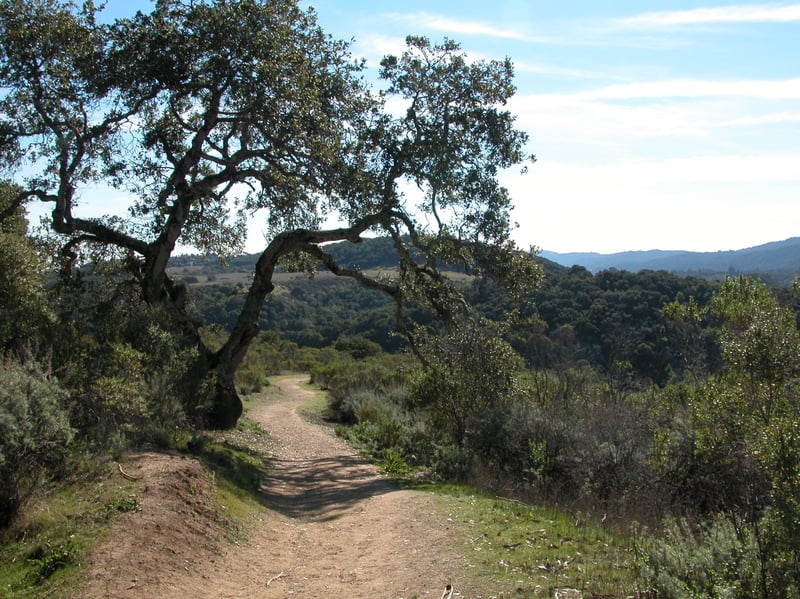
As the trail begins an easy descent, there are
sweeping views to the forested slopes of the Santa Cruz Mountains as well
as Edgewood Park, just across a canyon to the south. Sagebrush and coyote brush
line the trail initially, but after a while coast live oaks dominate.
Dick Bishop Trail ends at 2.15 miles. Turn right.
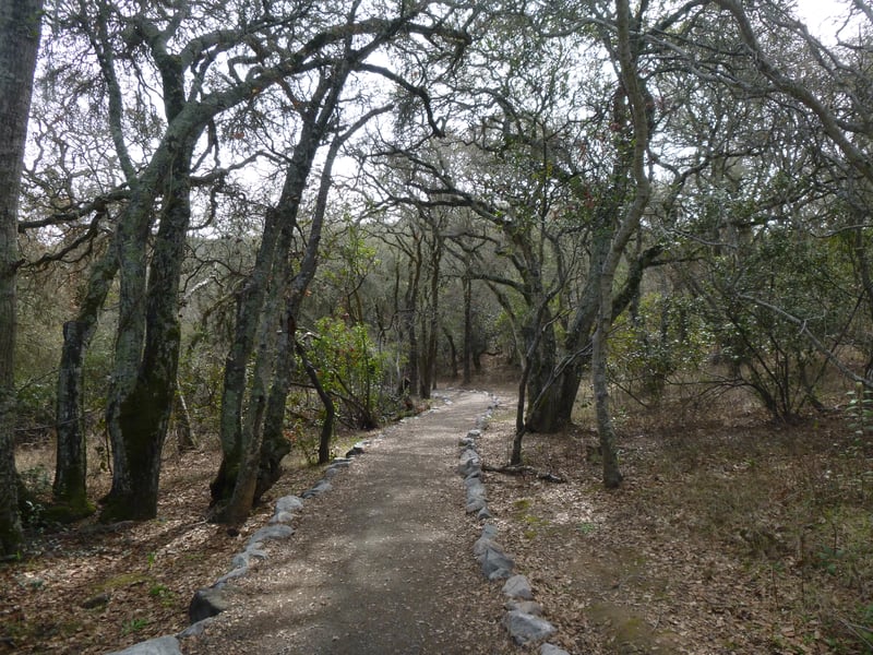
Blue and coast live oaks, California
bay, and madrone shade the narrow hiking-only trail. Indian warrior,
shooting stars, and hound's tongue make a strong showing from late winter
to early spring, and broom and poison oak are common. Switchbacks keep
the descent a gentle one. In mid-spring you might see fairy lanterns along
the trail. At 2.6 miles, Blue Oak Trail ends at the edge of the parking
lot.
Total mileage: 2.6 miles
Last hiked: October 3, 2017
Previous visits: November 23, 2004; February 24, 2004; May 2, 2001; and April 17, 2000