Russian
Ridge Open Space Preserve has a reputation as one
of the top bay area spots for wildflowers. But even when no flowers are blooming,
Russian Ridge is worth visiting. Very few parks and preserves in the bay
area can match Russian Ridge's lovely grassland hills. From the ridgeline,
and particularly Borel Hill (elevation 2572 feet), you can see to the ocean to the west,
all of the east bay hills and Mount Diablo to the east, and south to Mount Umunhum.
There are many loop options available at
Russian Ridge. From the vista point trailhead (one mile north of the main trailhead on
Skyline Boulevard), you can hike north on Ridge Trail, and then head downhill on Hawk
Trail, and back uphill to Ridge Trail and the vista point trailhead. The adjoining
MROSD preserves, Coal Creek and Skyline Ridge, can easily be entered from
either the vista point trailhead or the main trailhead. To experience
the grand loop of Russian Ridge combine the Ridge Trail with Hawk Trail,
Mindego Ridge Trail, and Ancient Oaks Trail, a 4.5 mile trek. The Bay
 Area Ridge Trail runs through Russian Ridge (rightly so), and just about
any hike through the preserve will include a stint on the trail. At the
western edge of the preserve the Mindego Trail heads to the top of an ancient volcano.
Area Ridge Trail runs through Russian Ridge (rightly so), and just about
any hike through the preserve will include a stint on the trail. At the
western edge of the preserve the Mindego Trail heads to the top of an ancient volcano.
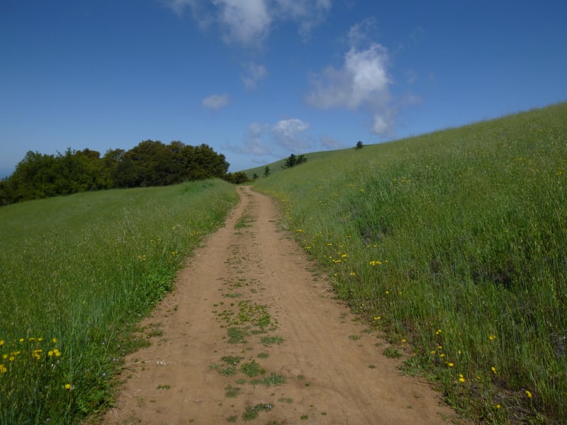
For the featured hike, start at the parking
lot and head uphill on the signed Ridge Trail. The straight, multi-use
path soon curves near an isolated cluster of buckeyes, and meanders
along a seasonal creek. On a hike one February a group of frogs croaked back and forth, camouflaged
in the damp grass. Ridge Trail continues a climb as it sweeps
south and then north again, until the grade tapers off and you reach the
ridge. Views to the south and east are spectacular. Ridge Trail in
Skyline Ridge Open Space Preserve is visible to the south. Butano Ridge
is prominent, a sturdy forested range between the Santa Cruz Mountains
and the sea. At a signed junction at about 0.6 mile, turn left (the
sign says "to Ancient Oaks Trail").
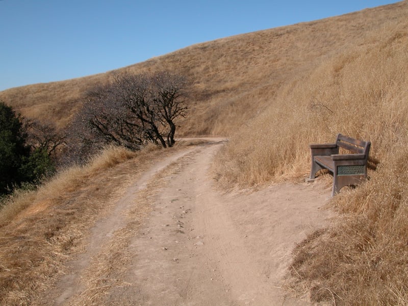
Drifting away from the ridgeline, the
path contours around a hill and passes a bench. Hawks, kestrels, and kites
can be seen swooping from treetops down to the grass. Alpine Road is visible
downslope to the left. The sides of the trail are punctuated with California
bay, buckeye, and live oaks. At 0.9 mile, Ancient Oaks Trail begins at
a signed junction. The trail left heads to a small pullout on Alpine Road;
the trail straight connects to Mindego Hill Trail. Turn right
onto Ancient Oaks Trail.
Initially Ancient Oaks Trail sidles along a grassy hillside. According to a district map
once posted on the information signboard at the trailhead, a 1999 controlled
burn was conducted on the right side of the trail, but not the left. In
February 2000, the right side was a deep emerald green, while the left
side was still dominated by dry brown grasses. This narrow path, open
to cyclists and equestrians as well as hikers, angles levelly across a
hillside, offering views to the ocean and the rolling hills that precede
 it. At about 1.2 miles, Ancient Oaks Trail comes to a signed junction
underneath some oaks and California bays. (To shorten your hike, take
the trail to the right, signed "to parking lot," and then turn
right onto the Ridge Trail and return to the trailhead.) Bear left,
continuing on Ancient Oaks.
it. At about 1.2 miles, Ancient Oaks Trail comes to a signed junction
underneath some oaks and California bays. (To shorten your hike, take
the trail to the right, signed "to parking lot," and then turn
right onto the Ridge Trail and return to the trailhead.) Bear left,
continuing on Ancient Oaks.
Moss-covered venerable live oaks line the
path, with a few madrone, Douglas fir, and California bay keeping the
old timers company. One oak on the left side of the trail has a hollowed-out
stump that serves as a catch basin, filling with water after a heavy rain.
In summer, you might see California sister butterflies fluttering from
oak to oak. The path emerges into grassland again, crosses a faint trail
and then ducks back into the woods. Ancient Oaks Trail creeps downhill
through a heavily shaded forest of California bay, madrone, and live oak.
Thick clumps of ferns, creambush, hazelnut, and blackberry bushes shelter
newts and spring wildflowers such as hound's tongue and starflower. At
about 1.55 miles, Ancient Oaks Trail ends at a signed junction. Charquin Trail (formerly Mindego
Ridge Trail) to the left continues through the woods until it emerges on
a ridge and then meets Mindego Hill Trail. Turn right onto Charquin Trail.
The wide trail crosses a few creeks and
streams running downhill to meet Mindego Creek. Look to the right slope
for pink-flowering currant bushes. They put out shocking bright
blossoms when we most need some beauty, in the dreary days of January
and February, and then fade gracefully away as the early wildflowers start to emerge.
Alders and thickets of blackberries give way to grassland as the trail ascends
gently to the northwest. At about 1.95 miles, the trail forks at a signed
junction. (The trail to the left splits again in 0.5 mile; stay to the
right on the Hawk Trail, then turn right onto Ridge Trail if you'd
like to extend your hike another 1.3 miles.) Bear right (the sign points
to vista point parking and the Ridge Trail) and head uphill.
 This short climb along the multi-use trail
will have you sweating on a hot summer day, but on a windy winter day
the higher you climb the more you may be buffeted by gusts. At about 2.25
miles, at a signed junction, the trail levels out and crosses Ridge
Trail on its way to the vista point trailhead. Turn right (there's
currently no sign when you're walking in this direction) onto Ridge
Trail.
This short climb along the multi-use trail
will have you sweating on a hot summer day, but on a windy winter day
the higher you climb the more you may be buffeted by gusts. At about 2.25
miles, at a signed junction, the trail levels out and crosses Ridge
Trail on its way to the vista point trailhead. Turn right (there's
currently no sign when you're walking in this direction) onto Ridge
Trail.
After a few feet of climbing, the trail forks,
at about 2.3 miles. Both paths meet about 0.5 mile south
on the other side of the hill. The left trail crests at Borel Hill, while
the right path, Ridge Trail, stays beneath the ridge line as it cuts
across the hillside. Take the trail to the right.
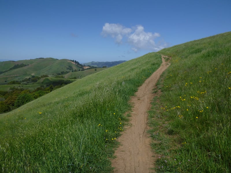
After the narrow Ridge Trail sweeps beneath
some moss-covered rocks, it contours around the grassy hillside.
Look west to see the segment of Charquin Trail you traversed earlier and
Mindego Hill (the extinct volcano). Deer and even coyote can sometimes be glimpsed downslope on the hill.
Bobcat prints mark the dirt trail, and mountain lion sightings have been reported in
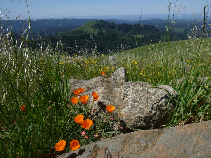
the last few years. Wildflowers including owl's clover, johnny-jump-up,
checker-bloom, lupine, filaree, clarkia, California poppy, blue-eyed grass,
mule ear sunflower, and tidytips sprawl across the grass in the the spring.
By summer, what in spring resembles a mowed lawn now may look like a wheat
field, with tall harding grass (a non-native) and wild oat baked brown
by the sun. At about 2.8 miles, at a signed junction, the path to Ancient Oaks Trail departs off the right side of the hill. Continue
straight/left on Ridge Trail. Shortly after, at about 2.9 miles, the
two ridge trails rejoin. Stay to the right.
In summer, look for a variety of butterflies
in this part of the preserve, including red admiral, buckeye, and American
lady. At about 3.1 miles, you'll arrive at the previously encountered
junction with the path to Ancient Oaks Trail. Continue straight/left
on Ridge Trail and retrace your steps to the trailhead, savoring
the views of Monte Bello, Skyline Ridge, and Mount Umunhum to the southeast.
Total distance: 3.7 miles
Last hiked: August 31, 2011
Previous visits: September 30, 2003; May 1, 2001; and February 21, 2000