I had been hiking on San Bruno
Mountain for about 20 years, but somehow I had overlooked the ridge. It's hard to excuse the oversite --
the ridge running southeast from the summit area is massive and visible from nearly every San Francisco hill.
But I never could get enough of the mountain's north slope and hiked it nearly every time I visited San Bruno.
Last year I decided to remedy my lapse. My ridge adventures made me giddy and completely enchanted my son.
The fire road is now his favorite local trail; he says it feels magical. I have to agree. In less than
1/2 hour we transition from our SF neighborhood to a quiet trailhead. Once we start hiking we savor incredible views
and delight in the variety of plants. Something is in bloom nearly ever visit. In the past year we've enjoyed
watching the weather change by the minute, from fog to sun and back again. And although the ridge is so close
to so many people, the trail is lightly used and very peaceful.
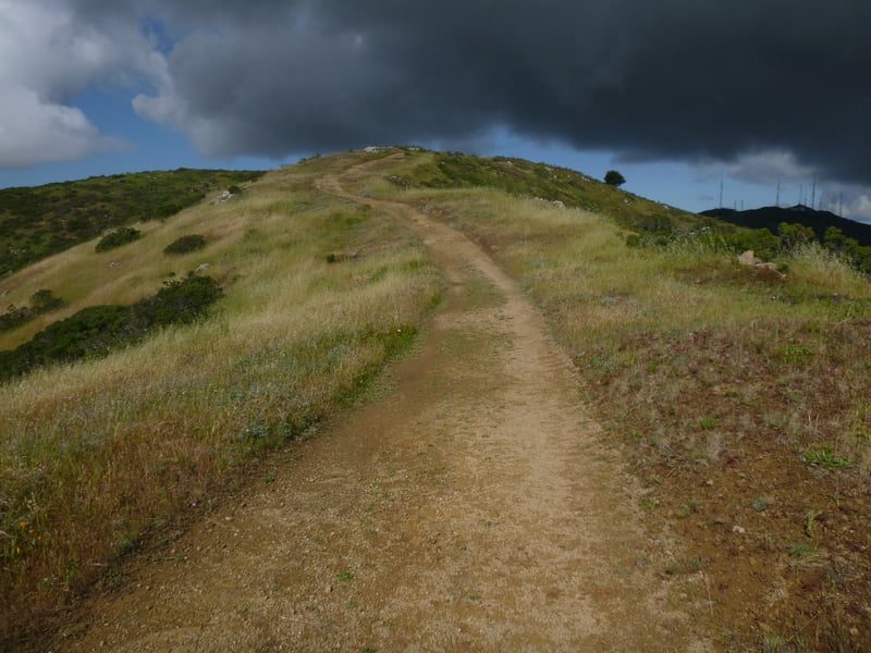
 Start from the gate at the edge of the parking lot. The wide fire road descends straight away. Look for coast rock cress and San Francisco wallflower blooming along the trail in March. At 0.1 mile, the hiking-only section of Ridge Trail breaks off on the left, skirting the hilltop on the way to meet Summit Loop Trail. That segment is worth a side trip, but for now continue straight on the fire road. Note the manzanita on the right, growing as a low groundcover. The trail bends right and drops sharply through coastal scrub. Wildflowers,
perhaps due to fog moisture, thrive here. You might see iris in winter and loads of cow parsnip and paintbrush in spring,
in shades from red to orange to pale peach.
Start from the gate at the edge of the parking lot. The wide fire road descends straight away. Look for coast rock cress and San Francisco wallflower blooming along the trail in March. At 0.1 mile, the hiking-only section of Ridge Trail breaks off on the left, skirting the hilltop on the way to meet Summit Loop Trail. That segment is worth a side trip, but for now continue straight on the fire road. Note the manzanita on the right, growing as a low groundcover. The trail bends right and drops sharply through coastal scrub. Wildflowers,
perhaps due to fog moisture, thrive here. You might see iris in winter and loads of cow parsnip and paintbrush in spring,
in shades from red to orange to pale peach.
The steep drop continues, pauses at the bottom, then rises to a hilltop cloaked in coyote
brush and other coast scrub shrubs, including ceanothus, coffeeberrry, and sagebrush. Great patches of hummingbird sage nourish local and
migrating hummers. As the fire road continues southeast, it rises and falls, making this trail a good choice
for runners or exercise. Without trees, views are unobstructed -- look for Bay Area landmarks,
including Mount Diablo, Montara Mountain, and many other major and minor peaks. The fire road passes under high-tension
power lines and continues along the ridgeline. Guadalupe Quarry is downslope to the left, but visible only from a few spots.
One hilltop is notable for a small rock formation -- my son and I labelled it Craven Rock, for nearly every time we've
hiked here there have been ravens and/or crows either sitting on the rock or flying nearby. Several times we also noted scat
from coyotes or bobcats, which surprised me, because I've only ever seen one coyote on San Bruno, and very little scat on Summit Trail.
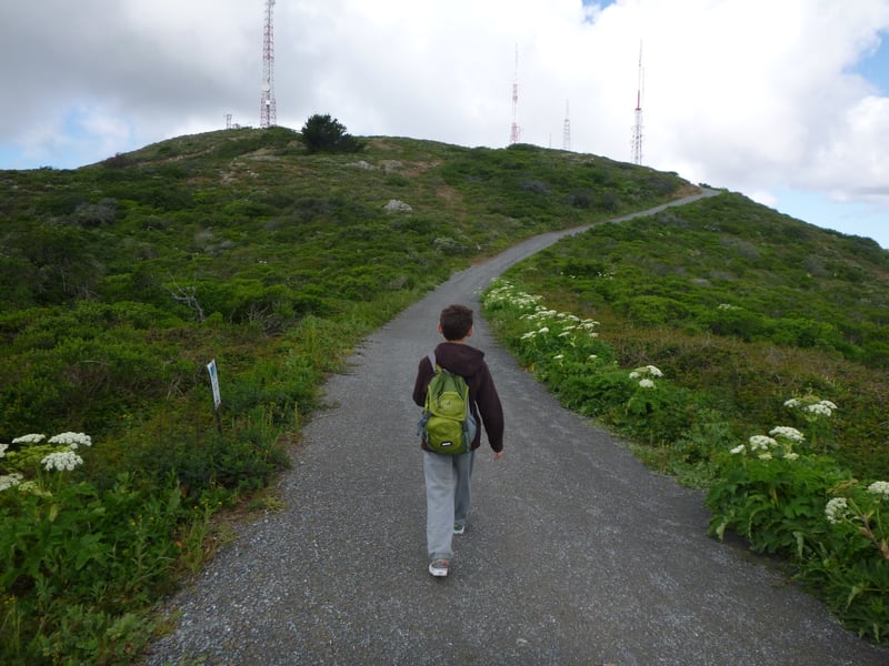
Trailside vegetation shifts to grassland and in May owl clover, California poppy, and clarkia
dot the golden hillsides. Half-mile markers continue to chart your progress. The fire road passes under a second set
of high-tension power lines. At 2.1 miles, the trail begins to descend sharply to the east -- this is the turn around
spot. Retrace your steps back to the trailhead.
Total distance: 4.15 miles
Last hiked: May 5, 2015