Sam
McDonald Park may suffer from a middle child complex. Larger
than Memorial Park but still dwarfed by Pescadero Creek Park, Sam McDonald
is the least known of the western slope Santa Cruz Mountains county park
triad. McDonald's initial 400 acres were acquired in 1958 (with more land
purchased in 1970), while Memorial's acreage was obtained in 1924 (it
is the oldest of the county parks), and youngest child Pescadero Creek
happened along in the 1970s. With an inconspicuous entrance on Pescadero
Road and limited facilities, families looking for the perfect campsite
or hikers planning long multi-day treks pass right by McDonald, on their
way to Memorial, Pescadero Creek, and adjacent Portola Redwoods State
Park. While Memorial and Portola feature drive-in campsites, at McDonald (as well as Pescadero Creek), you must hike or ride on horseback to a
limited number of campsites that require reservations.
All three of these county parks have distinct
personalities, but similar terrain. Redwood forests are prominent, and
trail networks string together steep fire roads with more gentle trails.
Bicycles are restricted to a handful of trails at Pescadero Creek, and
horses are commonly encountered in Pescadero Creek and McDonald (Memorial
does not permit them).
A detailed map of the three county parks
and Portola State Park is super helpful in planning long hikes. It's possible to dayhike Pescadero Creek and one of any other park in a single visit, and another option is to wander through all of
 them on a multi-day backpacking ramble. Adjacent parklands and easements permit a three county blockbuster trek, from the valley foothills of Rancho San Antonio Open Space Preserve west through
Monte Bello Open Space Preserve, south through Skyline Ridge and Long
Ridge Open Space Preserves, then west into Portola and Pescadero Creek.
From there you can go north to McDonald, east to Memorial, and/or south
into Big Basin.
them on a multi-day backpacking ramble. Adjacent parklands and easements permit a three county blockbuster trek, from the valley foothills of Rancho San Antonio Open Space Preserve west through
Monte Bello Open Space Preserve, south through Skyline Ridge and Long
Ridge Open Space Preserves, then west into Portola and Pescadero Creek.
From there you can go north to McDonald, east to Memorial, and/or south
into Big Basin.
If you want to spend the day at solely
within the confines of McDonald, several loop possibilities exist. Pescadero
Road cuts through the middle of the park, and most visitors head either
north or south from the main trailhead just off the road. Ridge Trail
Loop, about 3.5 miles, visits the north and south section of the park. Supplement that with an additional jaunt southeast on Towne Trail, and head back to the trailhead on Heritage Grove Trail, for a near six mile tour of the park. Folks out for a more gentle hike through redwoods
might opt for McDonald's Big Tree Loop. Although the 1 mile hike does
have some elevation to contend with, its diminutive length makes it a
reasonable choice for most.
Winter is muddy at McDonald, and storms
can significantly impact the trail conditions, but you are bound to find
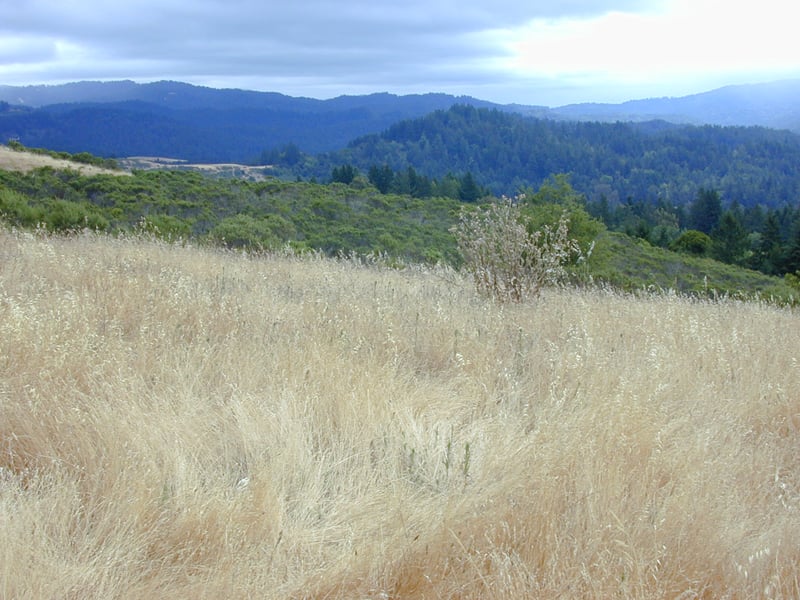
solitude that time of year. Visit in spring for wildflowers along the
high meadows of Towne Ridge and throughout the mixed woodland of Heritage
Grove Trail. Summer heat is mitigated by the dark shaded redwood groves,
and early in the season you might find orchids and thimbleberries in the
woods. In autumn huckleberries and big leaf maples are the draw.
McDonald's most unusual and prized feature
(besides the redwoods) may be Hikers' Hut, operated by the Sierra Club.
Perched near the high point of Towne Ridge, the A-frame building makes
great, rustic accommodations for a group. The hut has a simple kitchen
with drinking water, small common area, large wooden deck, and tiny upstairs
loft. There are no beds, but 14 sleeping mats are included. Many
hikers are fond of spending the night outside on the deck in agreeable
weather, easing the strain of the limited indoor sleeping space.
Vault toilets are located outside the hut.
Start at the south edge of the parking
lot, near the picnic area. A large park sign indicates the
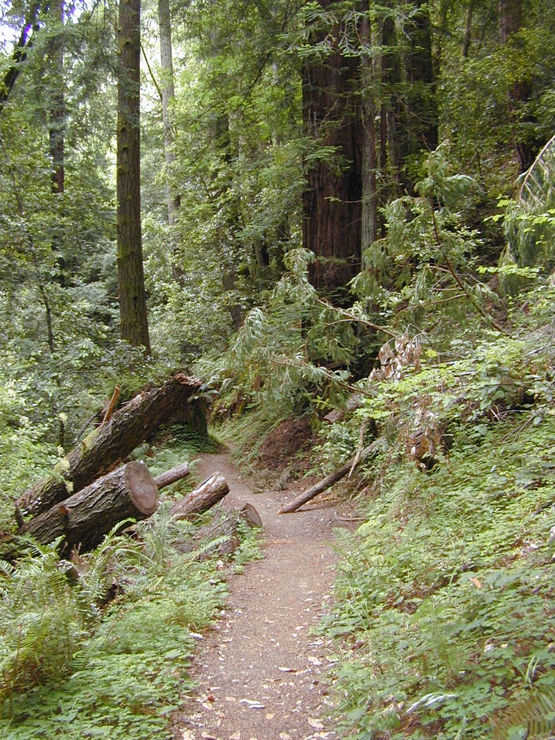
mileage to several prominent destinations; it's 14 miles from here to Big Basin State Park. Towne Trail, open to hikers and equestrians, heads into a redwood forest, with huckleberry, thimbleberry, ferns, hazelnut, and currant in the understory. After about 300 feet, the trail reaches
Pescadero Road. Carefully cross the pavement and rejoin Towne Trail
on the other side. The trail widens to fire road width, and begins
to climb somewhat steeply. A large water tank is visible, its squat shape
a contrast to the towering redwoods. At 0.35 mile, Big Tree Trail breaks
off to the left at a signed junction. Bear left onto Big Tree Trail.
The narrow hiking only path winds uphill,
then rejoins the fire road. Turn left. The two run together for
a short stretch, then Big Tree departs again, this time for good, on the
left at a signed junction. Bear left. Big Tree Trail begins a steep descent into
a gulch. Once at the forest floor, the trail winds at a more reasonable
grade. Redwoods dominate the landscape, but look closer to the ground
in spring for trillium, starflower, and redwood sorrel. At 0.7 mile,
 Heritage Grove Trail sets out to the right from a signed junction. Turn
right on Heritage Grove Trail.
Heritage Grove Trail sets out to the right from a signed junction. Turn
right on Heritage Grove Trail.
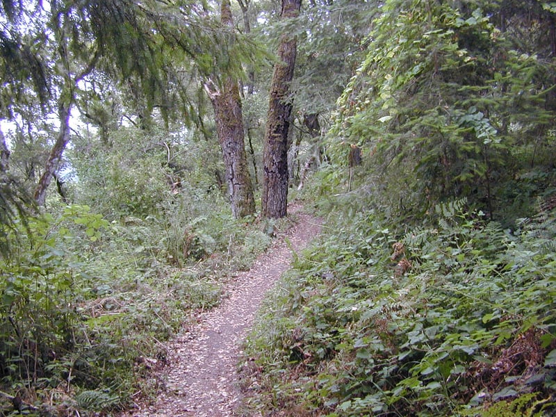
The narrow hiking only trail keeps a level
pace through the dense, dark forest of redwoods. Banana slugs are common. Tanoak, huckleberry, and hazelnut manage to eek out enough light to accompany
the Sequoia sempervirens. Orchid-like flowers including helleborine
and shinleaf wintergreen lend an exotic air to the trailside flora in
summer. Traffic noise from Alpine and Pescadero roads fades as you wander
through this very quiet section of the park. Rather abruptly, Heritage Grove Trail enters a mixed woodland, with California bay, coast live oak, Douglas fir, tanoak, and a few madrones lining the
path. Poison oak, creambush, ferns, ceanothus, and wild rose bask in the
dappled sunlight. Although redwoods quickly step back into the picture,
their dominance is diminished as they are mixed with other trees and plants.
Heritage Grove Trail crosses a creek and soon after reaches a signed junction
at 2.15 miles. The trail straight visits Heritage Grove, an option if
you'd like to extend the hike and see more redwoods. (The path ends at
Alpine Road; from there retrace your steps to this junction.) Turn
right and remain on Heritage Grove Trail, toward Hikers' Hut.
The hiking only trail climbs gently
through a scenic stretch of woods. Coast live oak, Douglas fir, California bay, big leaf
maple, and tanoak, along with thimbleberry, nettles, sticky monkeyflower,
gooseberry, creambush, currant, hazelnut, and blackberry line the path.
Look for hound's tongue in early spring, and the shiny red berries of
baneberry (poisonous) in summer. The trail winds uphill like a slithering
snake, but then takes a sharp turn to the right and climbs straight uphill.
Just past a gate and stile, the trail steps out into a pretty meadow rimmed
with Douglas fir. A few steps later, at 2.9 miles, Heritage Grove Trail
ends at a signed junction with Towne Fire Road. Turn left, but instead
of the fire road, take the slight but obvious trail that heads back
into the woods.
The path winds uphill, passes a massive multi-limbed Douglas fir, then reaches Hikers' Hut at 3 miles. Unless you have a reservation, continue
uphill on a path that dumps unto a wide dirt track. After a short descent, the fire road feeds into Towne Fire Road. Bear left. At 3.4 miles, Towne Fire Road swings around a belvedere. Continue straight to the hilltop and viewpoint. At elevation 1316 feet, there are unobstructed views of
the forested ridges to the south. This is a nice place for a lunch break
if it's not too hot. When you're ready, turn around, retrace your steps back to the previously encountered junction with the fire road leading to the Hikers' Hut. Bear left and
head downhill on Towne Fire Road. The hiking and equestrian fire road descends
easily, with creambush, coyote brush, poison oak, and a big leaf maple
lining the way. At 3.9 miles, you'll reach a junction with Heritage Grove Trail and a connector to Brook Loop Trail. Continue straight on Towne Fire Road.
The trail bisects a pretty meadow, where
even in summer a few California poppies enliven the blonde grass. Brook
Loop Trail runs a few feet to the left, bordering a descending hillside
of coyote brush. Towne Fire Road makes a brief foray through a mixed woodland,
then reemerges into thistle-choked grassland. At 3.4 miles, Brook Loop
Trail feeds into Towne Fire Road from the left. Continue straight on Towne
Fire Road. (Brook Trail heads south into Pescadero Creek County Park.)
After a slight descent, you'll pass through/around
a gate, and reach the junction with Horse Camp at 4.6 miles. Turn
left, and then a few steps later, turn right at a signed junction,
to "McDonald Ranger Station." (From here you could extend your
hike into the northern section of the park. Continue straight
on Ridge Trail, and once across Pescadero Road, look for Forest Loop to
the right. Take this path back to the trailhead.)
You might see quail and deer along
the trail, which quickly begins to descend back into a redwood forest.
The steep slopes of a gulch fall away to the right. Traveling in this
direction, you might notice blackened bark on only one side of the redwood
trunks, evidence that a fire once ripped down the canyon to the north.
As you make progress downhill, traffic noises from Pescadero Road drift
uphill. Stay on the fire road as you pass two previously encountered
junctions with Big Tree Trail, then retrace your steps back to the trailhead.
Total distance:
5.2 miles
Last hiked: Wednesday, June 28, 2001