Briones
is a great place throughout the year, but in the spring
the park really shines. Or maybe I should say blooms. Wildflowers, lots
of 'em, thrive on the high slopes of the grassy hills here. Great patches
of California buttercups, filaree, California poppies, lupines, fiddlenecks,
and creamcups stand out against the lush green grass. Although cows graze
here (making the trails wet, muddy, and rutted in the winter, and dry,
dusty, and rutted in the summer) as in many hilly parks, flowers blooming
near the crests are largely unmunched.
Even when the wildflowers aren't in full
splendor, Briones has a lot to offer. Five staging areas (including Lafayette
Ridge Staging Area) provide ample parking, and some trailheads feature
 picnic facilities and reservable youth campsites. With a roughly circular
shape and over 5,000 acres,
there are a plethora of loop options. Most include a hike up to Briones
Crest, which is near the center of the park. The highest elevation at
Briones is under 1500 feet, so there are no strenuous climbs, although
some trails do wander up and down a bit. Nearly all the trails here are
open to cyclists and equestrians as well as hikers, so do expect to share
the trails.
picnic facilities and reservable youth campsites. With a roughly circular
shape and over 5,000 acres,
there are a plethora of loop options. Most include a hike up to Briones
Crest, which is near the center of the park. The highest elevation at
Briones is under 1500 feet, so there are no strenuous climbs, although
some trails do wander up and down a bit. Nearly all the trails here are
open to cyclists and equestrians as well as hikers, so do expect to share
the trails.
For the featured hike, walk through the
gate on the paved road at the edge of the parking lot. Old Briones
Road starts out as a flat paved path, angling through coyote brush and
small coast live oak and elderberry trees. You will probably see cattle
right away, and more throughout the valley. At 0.13 mile, Homestead Valley
Trail splits off from Old Briones Road at a signed junction. (Homestead
Valley Trail is sometimes closed because of storm damage, but
when the trail is open it makes a fine option for the climb up to Briones'
lagoon area; just take Homestead Valley to Briones Crest Trail and resume
the feature hike at the junction of Briones Crest and Old Briones Road.)
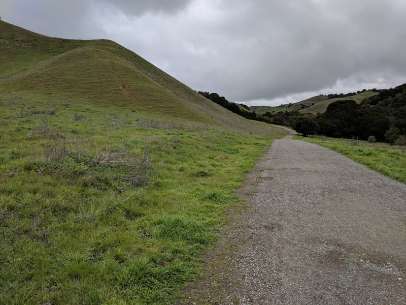
Continue straight on Old Briones Road.
The broad dirt multi-use trail crosses
through a cattle gate and enters grassland. In spring, your first course
of flowers may be presented off the left side of the trail: poppies lightly
sprinkled over the upper slopes of green hills. Briefly, Old Briones
Road seeks shelter beneath some California bay, coast live, valley, and
black oaks. California buttercups brighten the understory in spring.
 When the fire road emerges back into grassland, Black Oak Trail sets off
from a signed junction at 0.64 mile. Keep going straight on Old Briones
Road.
When the fire road emerges back into grassland, Black Oak Trail sets off
from a signed junction at 0.64 mile. Keep going straight on Old Briones
Road.
After another flat stretch through a pastoral
setting, Old Briones Road crosses a creek near a corral, then meets Valley
Trail at a junction at 1.0 mile. (Valley Trail is another option to extend your hike a bit. The hiking,
biking, and equestrian trail continues at a flat grade, then climbs to
a junction with Briones Crest Trail. Take a left on Briones Crest Trail,
pass the park's high spot, Briones Peak, and then rejoin the featured
hike at the junction of Briones Crest Trail and Old Briones Road.) Bear
left to stay on Old Briones Road, and begin the ascent to the crest.
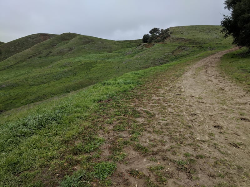
In spring, your hike uphill will probably
be enlivened by a variety of flowers. California buttercups cover
entire hillsides with blasts of yellow. Delicate white woodland stars,
bluedicks, various lupines, and yellow fiddlenecks all may be on display
on the sides of the trail. In the hills' damp creases buckeye, California
bay, and elderberry trees grow, with poison oak a frequent companion.
If you happen to visiting the park at "poppy peak," you may notice hilltops at the crest flushed with
orange from blooming California poppies. Purple lupines accompany California
sagebrush in the dry rocky patches on the right side of the path. The
views back down and across the valley seem to become more lovely with
each step. After a moderate climb, Old Briones Road reaches the crest
and a signed junction at 1.64 miles. But before you cross through the
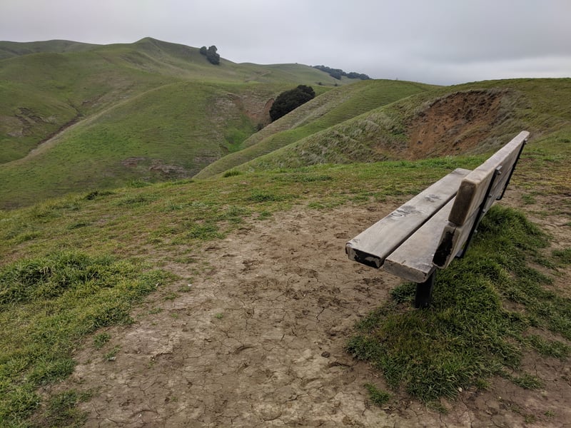
fence and reach that junction, look for a slight path to the left, leading
along the fence uphill to a bench. Turn left and walk toward the bench.
 After a short slight climb, you'll reach the bench a a lovely view spot. In April, expect truly
spectacular displays of California poppy, creamcups, clover, and lupine sprawling down the hill.
Even if it's not spring, the bench makes a nice rest spot, with tremendous
views of the west part of the park. It's also a fantastic place for bird
watching. Bluebirds nest in boxes attached to the fence, so they are commonly spotted, as
are kestrel, hawks, kites, and lots of smaller birds. Just over the other side
of the fence to the east the Maricich Lagoons can be glimpsed. When you're ready to continue,
walk back to Old Briones Road, pass through the gate, then turn left.
After just a few steps, at 1.74 miles, the trails split at a signed junction.
Bear left on Briones Crest Trail.
After a short slight climb, you'll reach the bench a a lovely view spot. In April, expect truly
spectacular displays of California poppy, creamcups, clover, and lupine sprawling down the hill.
Even if it's not spring, the bench makes a nice rest spot, with tremendous
views of the west part of the park. It's also a fantastic place for bird
watching. Bluebirds nest in boxes attached to the fence, so they are commonly spotted, as
are kestrel, hawks, kites, and lots of smaller birds. Just over the other side
of the fence to the east the Maricich Lagoons can be glimpsed. When you're ready to continue,
walk back to Old Briones Road, pass through the gate, then turn left.
After just a few steps, at 1.74 miles, the trails split at a signed junction.
Bear left on Briones Crest Trail.
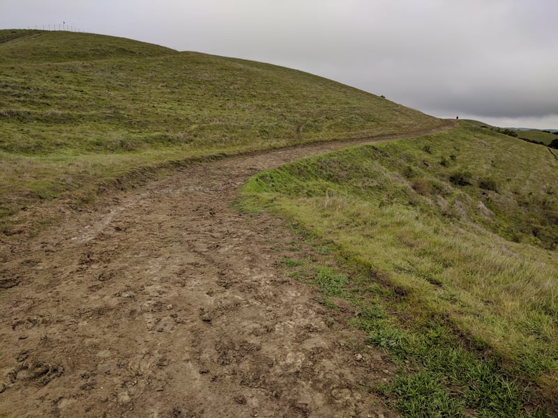
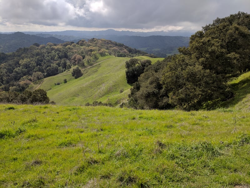
The wide multi-use trail winds along the
crest through grassland. A view back over your shoulder on a clear day
could include Mount Diablo. Some coast live oaks line the trail on the
right side in sections, but the left remains soft rolling grassy hills.
Buttercups seem to favor area in spring. One of the Sindicich Lagoons comes into
view on the left edge of the Briones Crest Trail. This part of Briones
has been designated the John Muir Nature Area, and steps are taken to
keep cows (and humans presumably) from harming the park's natural features. Lagoon Trail departs
from the left side of the trail at a signed junction opposite the lagoon at
2.02 miles. (Lagoon is another good option for extending this hike a little
over 2 miles. Take Lagoon to Briones Crest, turn left, and then turn right
when you get to Mott Peak Trail.) Continue straight on Briones Crest
Trail.
The second Sindicich lagoon is visible to the right as the trail
climbs slightly in a nearly straight section. At 2.32 miles, at a signed
 junction Mott Peak Trail begins on the left side of the trail. From here,
all trails start to descend and leave the crest area. Turn left on
Mott Peak Trail.
junction Mott Peak Trail begins on the left side of the trail. From here,
all trails start to descend and leave the crest area. Turn left on
Mott Peak Trail.
Mott Peak Trail, another broad multi-use
fire road, climbs for a few yards, then crests, crosses through a gate,
and starts a descent. Off the left side of the trail, on one spring hike
I was stopped in my tracks by a display of orange poppies sweeping uphill
past an oak, like a freeze frame of a small brush fire. Yellow fiddlenecks
were the prevalent wildflower along the trail on an April hike, but you might also see more poppy, filarees,
and lupine. At 2.74 miles, Mott Peak Trail meets Black Oak Trail at a
signed junction. (Mott Peak continues downhill until it ends at Abrigo
Trail, which is an optional route. Turn left on Abrigo and then at the
parking lot, turn left and walk along the road back to the trailhead.)
Bear left onto Black Oak Trail.
The trail, open to cyclists and equestrians as
well as hikers, dips, rises again, then levels out along a ridge. From
a bench on the left side of the path, vistas to the east include Mount
Diablo, and Briones Crest. To the north more rolling hills stretch to
Suisun Bay. Black Oak Trail's drop back into the valley is also visible.
As the trail descends, another bench sits off the trail, near an oak-studded
hillside. Then Black Oak Trail turns and shoots steeply downhill. In the
spring, there may be many flowers in bloom. I've seen redmaids, woodland
star, blue-eyed grass, and California buttercup in early April. Off to
the left, a few buckeyes and California bays thrive near the creekbed.
The trail sweeps right, crosses through the valley, then ends at the previously
encountered junction with Old Briones Road at 3.74 miles. Turn right
here and retrace your steps to the trailhead.
Total distance: 4.38 miles
Last hiked: March 8, 2018
Previous visits: April 5, 2000 and April 10, 2002