Chabot
Park is a nice companion to its neighbor, Redwood Park. The
two parks are separated only by narrow Redwood Road, and with an interconnected
trail system, you can hike for hours on a long segment of the the Bay
Area Ridge Trail, through both parks. While Redwood is dominated by its
namesake trees and a riparian corridor, with just a bit of chaparral,
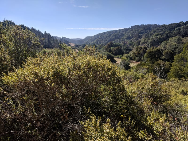
Chabot features a lake, meadows and grassland, eucalyptus, oak, and California bay forest, and
lots of chaparral. At the southeastern end of Chabot, Lake Chabot is a
focal point, and the area has been developed with a public golf course,
family campground, and marina. The northwestern edge, which borders Redwood
Park, and the middle of Chabot are less developed, although there is a
(group) campground at Bort Meadow.
With 9 trailheads
 (the EBRPD calls the largest of these staging areas), Chabot offers many
choices when it comes to hiking. MacDonald Staging Area, on the park's
northeastern edge, serves both Chabot and Redwood parks. Going south,
Marciel Gate, and the other trailheads off Marciel Road, are the last
subdued set-off points before you reach the developed parking areas at
Willow Park Golf Course and Lake Chabot Marina. Starting from Bort Meadow
Staging Area allows you to wander southeast or northwest, and it's my
favorite trailhead at Chabot. From here you can take an out-and-back hike
west through chaparral on MacDonald Trail (a segment of the Bay Area Ridge
Trail), or just wander downhill to Bort Meadow and lie
in the grass. Grass Valley Trail (another segment of the Bay Area Ridge
Trail) meanders levelly south through the valley and joins with Brandon
Trial on a march through eucalyptus forests. Brandon runs all the way
to the eastern edge of the park, ending near the Proctor Staging Area.
(the EBRPD calls the largest of these staging areas), Chabot offers many
choices when it comes to hiking. MacDonald Staging Area, on the park's
northeastern edge, serves both Chabot and Redwood parks. Going south,
Marciel Gate, and the other trailheads off Marciel Road, are the last
subdued set-off points before you reach the developed parking areas at
Willow Park Golf Course and Lake Chabot Marina. Starting from Bort Meadow
Staging Area allows you to wander southeast or northwest, and it's my
favorite trailhead at Chabot. From here you can take an out-and-back hike
west through chaparral on MacDonald Trail (a segment of the Bay Area Ridge
Trail), or just wander downhill to Bort Meadow and lie
in the grass. Grass Valley Trail (another segment of the Bay Area Ridge
Trail) meanders levelly south through the valley and joins with Brandon
Trial on a march through eucalyptus forests. Brandon runs all the way
to the eastern edge of the park, ending near the Proctor Staging Area.
Equestrians are commonly encountered on the trails
at Chabot, although less so in the winter, when the equestrian center
on Skyline Boulevard is closed. Trails can get quite hot in the summer,
so spring and autumn are the best times of year to visit. Some wildflowers
bloom throughout the park, and a hike through the grassland and chaparral-lined
slopes can be an education in bay area plants.
For the featured hike, head downhill
on the paved road near the entrance to the staging area. Coyote brush
and poison oak line the route. A glance to the left reveals the valley
you will soon be hiking through. At 0.10 mile, the pavement ends and the trail splits at a signed 3-way intersection. The wide trail right goes to Bort Meadow. The trail straight is a spur to Brandon Trail. Turn left, onto Grass
Valley Trail.
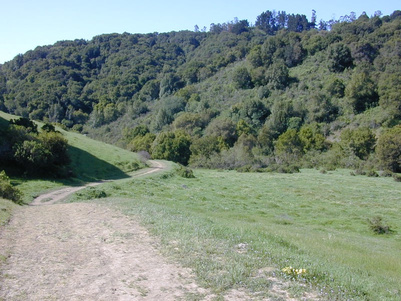
Grass Valley, a wide multi-use trail, is curvy
 and almost flat. This segment is part of the Bay Area Ridge Trail and
the East Bay Skyline National Recreation Trail. In spring, the grassy
hillsides of this valley are dotted with wildflowers, most notably yellow
suncups, and tiny purple-blossomed filaree, which produces a carpet effect
in places. Cows graze through the valley, so the grass is kept short and
neat. A few oaks produce shade on the edge of the trail, but for the most
part you'll walk under full sun. Coyote brush and poison oak continue
to be prominent plants along the sides of the trail, although some occasional
broom shrubs lend a sweet aroma and yellow flowers in the spring. At 0.9
mile, Redtail Trail sets out from the left side of the trail at a signed
junction. (Redtail climbs to the Marciel Gate; you can make an extra loop by taking
Redtail to Cottontail, and then turning right onto Grass Valley Trail,
after which you can pick up this featured hike at the stone bridge.) Continue
straight on Grass Valley Trail.
and almost flat. This segment is part of the Bay Area Ridge Trail and
the East Bay Skyline National Recreation Trail. In spring, the grassy
hillsides of this valley are dotted with wildflowers, most notably yellow
suncups, and tiny purple-blossomed filaree, which produces a carpet effect
in places. Cows graze through the valley, so the grass is kept short and
neat. A few oaks produce shade on the edge of the trail, but for the most
part you'll walk under full sun. Coyote brush and poison oak continue
to be prominent plants along the sides of the trail, although some occasional
broom shrubs lend a sweet aroma and yellow flowers in the spring. At 0.9
mile, Redtail Trail sets out from the left side of the trail at a signed
junction. (Redtail climbs to the Marciel Gate; you can make an extra loop by taking
Redtail to Cottontail, and then turning right onto Grass Valley Trail,
after which you can pick up this featured hike at the stone bridge.) Continue
straight on Grass Valley Trail.
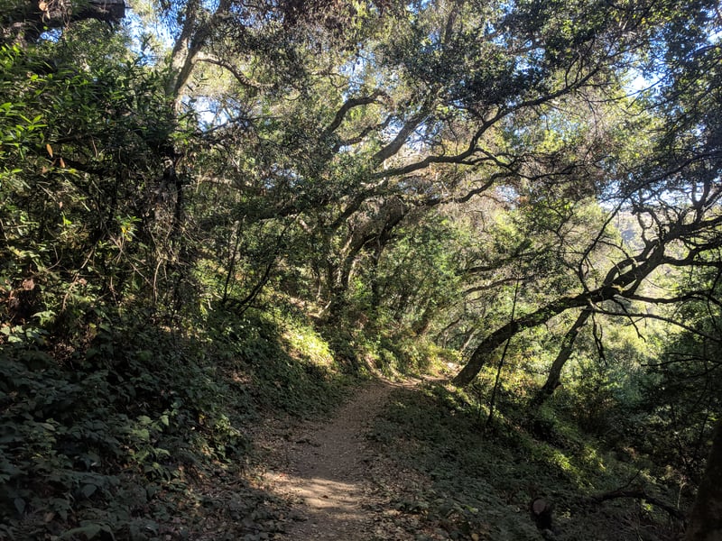
The dirt path winds slightly downhill, and the
grass gives way to tall eucalyptus and a few redwood trees. At 1.6 miles Grass
Valley Trail comes to a junction near the stone bridge. Grass Valley Trail
continues uphill to the left. Turn right and cross Grass Valley Creek
(a good rest spot), then reach a multiple junction. Brandon Trail heads to Bort Meadow on the right.
Cascade Trail follows Grass Valley Creek to the left. Walk uphill on Jackson Grade.
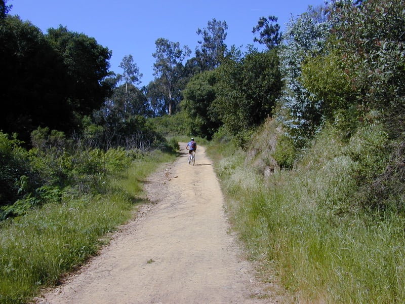
Jackson Grade is a multi-use dirt fire road
that climbs pleasantly through partial shade. You may see orange sticky monkeyflower and purple bush
lupine in spring. Maple, creambush, hazelnut, blackberry, wild rose, toyon,
coast live oak, and coffeeberry
mix together on the sides of the trail. Eucalyptus towers over all. After
an easy climb to the ridgeline, Jackson Grade reaches a signed junction
at 1.9 miles. Turn right onto Goldenrod Trail.
 Goldenrod, a dirt multi-use trail, climbs
a bit. Tall, scrawny eucalyptus trees tower above the chaparral-covered
ridge. To the right views encompass the eastern section of the park. Goldenrod
is mostly level, with an occasional uphill stretch. Very little
shade makes for hot hiking in the summer. Blue witch nightshade grows
on the side of the hill, along with blue elderberry, toyon, poison oak,
and monkeyflower. Yellow-blossomed broom, an invasive pest plant, has
a strong foothold among the plants in this chaparral community. In spring,
you may see checkerbloom, bluedicks, blue-eyed grass, scarlet pimpernel,
California poppy, and purple bush lupine. Goldenrod Trail nears Skyline
Boulevard and then stays close to the road at about the 3 mile mark. Jalquin Trail feeds
in from the left. Continue straight/right on Goldenrod Trail.
Goldenrod, a dirt multi-use trail, climbs
a bit. Tall, scrawny eucalyptus trees tower above the chaparral-covered
ridge. To the right views encompass the eastern section of the park. Goldenrod
is mostly level, with an occasional uphill stretch. Very little
shade makes for hot hiking in the summer. Blue witch nightshade grows
on the side of the hill, along with blue elderberry, toyon, poison oak,
and monkeyflower. Yellow-blossomed broom, an invasive pest plant, has
a strong foothold among the plants in this chaparral community. In spring,
you may see checkerbloom, bluedicks, blue-eyed grass, scarlet pimpernel,
California poppy, and purple bush lupine. Goldenrod Trail nears Skyline
Boulevard and then stays close to the road at about the 3 mile mark. Jalquin Trail feeds
in from the left. Continue straight/right on Goldenrod Trail.
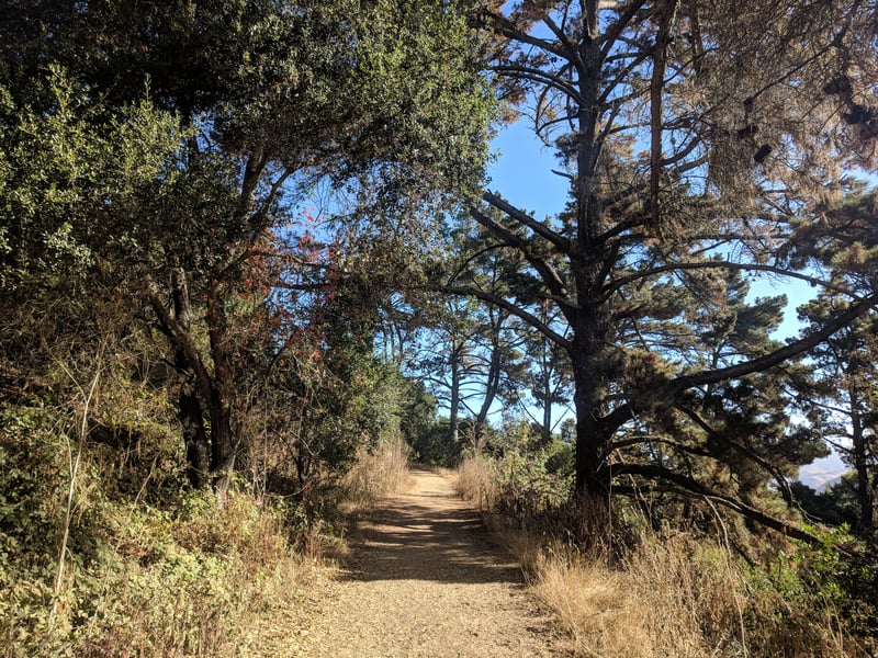
Continuing northwest, eucalyptus trees fade away
and are replaced by some pines. The buildings of the equestrian center come into view
just before a junction at 3.7 miles. The signpost may be hard to see when surrounding vegetation is tall.
Turn left to stay on Goldenrod before the gated trail
crosses into the equestrian center.
The trail cuts through some grass right beside Skyline Boulevard, then drops
away from the street, crosses the access road to the equestrian center,
and returns to chaparral. At 3.9 miles a path to the right leads to Horseshoe
Trail, which drops down and meets Brandon Trail in the valley -- this is a good option if you want a shorter
hike. Continue straight on Goldenrod.
Cow parsnip pushes up white flowers on tall thick
stems on the side of the trail in spring. Look for the delicate white
woodland star flowers in the shade, and colorful scarlet pimpernel and
redmaids growing close to the ground in the sun. By late summer most wildflowers
have closed up shop for the year, with the exception of California fuchsia. These bright red flowers
 hang in there sometimes through September. To the right (east),
if it's clear you should be able to see all the way to Las Trampas Ridge.
In the foreground Grass Valley Trail and Redwood Road are visible. To
the north MacDonald Trail stands out as it traverses the ridge. At one
point the trailhead is obvious, and you can check to see if your car is
still there! Back on Goldenrod Trail, purple bush lupine thrives in the
sun alongside California
sagebrush and California poppies. The trail curves across the hillside
where blackberries and creambush are abundant. At 4.5 miles, the trail
appears to end at an unsigned junction with a service road. Turn right,
and walk on the pavement past the water tank. The trail returns to dirt. A few maples accompany hazelnut and creambush on the left side of the trail. At 4.9 miles, Buckeye Trail begins at a signed junction
just before Goldenrod shoots uphill. When open, this path is another option for a shorter hike -- it heads steeply
downhill and ends at Bort Meadow. Continue straight on Goldenrod Trail.
hang in there sometimes through September. To the right (east),
if it's clear you should be able to see all the way to Las Trampas Ridge.
In the foreground Grass Valley Trail and Redwood Road are visible. To
the north MacDonald Trail stands out as it traverses the ridge. At one
point the trailhead is obvious, and you can check to see if your car is
still there! Back on Goldenrod Trail, purple bush lupine thrives in the
sun alongside California
sagebrush and California poppies. The trail curves across the hillside
where blackberries and creambush are abundant. At 4.5 miles, the trail
appears to end at an unsigned junction with a service road. Turn right,
and walk on the pavement past the water tank. The trail returns to dirt. A few maples accompany hazelnut and creambush on the left side of the trail. At 4.9 miles, Buckeye Trail begins at a signed junction
just before Goldenrod shoots uphill. When open, this path is another option for a shorter hike -- it heads steeply
downhill and ends at Bort Meadow. Continue straight on Goldenrod Trail.
After a short climb, the trail mostly levels out, passing through
pockets of coast live oaks and California bays. At 5.2 miles, turn right from a signed junction onto
Ranch Trail.
Narrow Ranch Trail (closed to bikes) begins a sharp descent. At first the
path is well-shaded by California bays and coast live oaks, with thimbleberry, ferns, poison oak, and even a little
huckleberry, in the understory. About 1/2 way downhill Ranch Trail steps out into grassy chapparal and adopts a series of switchbacks, at still quite a steep grade. Finally, the trail flattens across an area muddy in spring and reaches a
gate at 5.6 miles. Once through the gate, turn right.
You're now back on Grass Valley Trail, passing through a damp meadow on a wide track. Gradually the trail narrows to a nearly-flat single path cut through coyote brush. Some tall eucalyptus loom ahead. Coast live oaks join the party. In late summer, red berries dangle from honeysuckle vines, shining like jewels in the sun. At 5.9 miles you'll reach the eucalyptus and a gate. Bort Meadow is to the right (with drinking water and pit toilets). Turn left onto a small path (easy to miss) running parallel to the paved road.
This slip of a trail passes through coyote brush,
poison oak, and eucalyptus. There are quite a few plum trees along the
trail, and when the fruit is ripe you might see animals ranging from birds
to coyote gorging on the sweet plums. In spring California buttercups
and blue-eyed grass draw your attention to their colorful petals. At 6.1
miles the trail forks at a signed junction; Grass Valley trail goes right. Stay to the left and continue uphill. At the crest of a hill, the spur ends at a signed T junction with MacDonald
Trail, at 6.2 miles. Turn right and walk the few remaining steps to
the gate at the edge of the parking lot.
Total distance: 6.3 miles
Last hiked: April 22, 2002
Previous visit: April 3, 2000