Every
time I hike at Reinhardt Redwood Regional Park (particularly from this trailhead),
I am reminded what a truly fantastic open space it is. And I think, (in a variation
of the Berkeley Farms radio spots) redwoods in the east bay? Moo! Redwoods
would not be the tree to come to mind when most hikers think of the east
bay, but Redwood Regional Park has some beauties, plus there's chaparral,
a stream where trout spawn, an incredible variety of plants, and a terrific
trail system, with plenty of paths just for hikers.
Perhaps the most striking
bit of history about the area (part of which was the former land grant
El Rancho de Los Palos Colorados) is that trees from the original redwood
forest were used by ship captains in the 1800's to navigate into San Francisco
Bay. Logging obliterated the virgin stands between 1840 and 1860; the
redwoods we see today are not very old, (second and third generation)
but really any stand of redwoods is dramatic and majestic.
Redwood is a large park with
a few major trailheads, and many minor ones. The main park entrance, off
Redwood Road, offers the most parking, and easy access to picnic and group
 areas. On weekends (when an admission fee is charged) the Canyon Meadow
Staging Area (at the end of the park road) can get rowdy with teenager
parking lot parties. The Skyline Gate Staging Area seems to be used more
by adult locals, but the parking lot can get full on weekends. You can
also walk into Redwood from the north or south -- Skyline National Trail
and the Bay Area Ridge Trail run through Redwood and then onto parklands
in both directions; Anthony Chabot Regional
Park to the south and Huckleberry Regional
Botanic Preserve to the north.
areas. On weekends (when an admission fee is charged) the Canyon Meadow
Staging Area (at the end of the park road) can get rowdy with teenager
parking lot parties. The Skyline Gate Staging Area seems to be used more
by adult locals, but the parking lot can get full on weekends. You can
also walk into Redwood from the north or south -- Skyline National Trail
and the Bay Area Ridge Trail run through Redwood and then onto parklands
in both directions; Anthony Chabot Regional
Park to the south and Huckleberry Regional
Botanic Preserve to the north.
Once inside Redwood Park, myriad loops are possible.
The easiest hike starts at the Canyon Meadow Staging Area and is a simple
flat out-and-back stroll on shady Stream Trail. For a bit more elevation
gain, any of the mid-slope trails, such as Orchard, Bridle, and French, can be combined with the Stream Trail for a pleasant, not too hard loop. The toughest circuits in the park (though still really
moderate hikes) climb from the canyon floor to either ridgeline.
You can create a loop which varies in length, from as short as 3 miles,
to more than 8 miles. Camping facilities are available at Redwood; contact
the park for more information and reservations. With so many people living
on the fringes of the park, there are many social trails and shortcuts.
Please stay on the designated trails (this is a well-signed park).
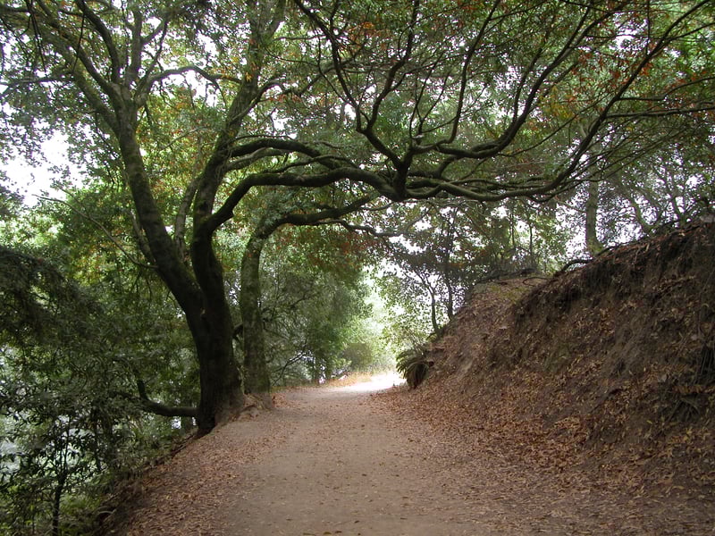
For the featured hike, walk to the south
corner of the parking lot (the opposite end from the portable toilets),
and look for the signed West Ridge Trail. The multi-use path is initially
wide and flat, and gets abundant use as an exercise track for joggers,
cyclists, and dogwalkers. Eucalyptus trees tower overhead, accompanying
California bay, madrone, pine, toyon, broom, sticky monkeyflower, poison
oak, coast live oak, elderberry, coyote brush, honeysuckle, common snowberry,
and blackberry. In late spring, creambush and hazelnut are conspicuous;
creambush with frothy white flowers, and hazelnut with edible nuts. You
get a great view almost right away, out of the canyon on the left side
of the trail. Later on, you might catch a glimpse of Mount Diablo, if
the skies are clear. In winter, look for several currant bushes (the only
pink-purple bright blooming shrub in January and February) on the right
side of the trail. At 0.5 mile, French Trail sets out downhill on the
left side of the trail at a signed junction. (French is an option if you'd
like to get off the Ridge Trail; follow French to Tres Sendas, turn left,
and follow the remaining directions). Continue straight on West Ridge.
As the trail edges along the high slopes of a
canyon, there are views downslope of the redwood filled gorge. Patches
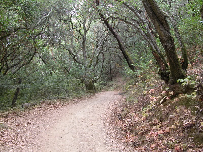 of huckleberry bushes and ferns thrive on the right side of the trail.
At 1 mile, at a signed junction, Tres Sendas Trail begins on the left.
(You can extend your hike on West Ridge and descend to Stream Trail on
your choice of trail.) Turn left onto Tres Sendas.
of huckleberry bushes and ferns thrive on the right side of the trail.
At 1 mile, at a signed junction, Tres Sendas Trail begins on the left.
(You can extend your hike on West Ridge and descend to Stream Trail on
your choice of trail.) Turn left onto Tres Sendas.
The narrow path, closed to cyclists, quickly
leaves the varied vegetation behind and descends to dark shaded stands
of redwoods and California bay along a fern-lined creek. Hazelnut, ferns,
and creambush are the dominant understory plants. In wet months, the steep
sections can get slippery, and muddy where the path crosses the creek
several times. At one dip in the path two California bays arch over the
trail. At 1.45 miles, Tres Sendas meets French Trail at a signed junction.
Continue straight on Tres Sendas.
The two trails run together, until French
breaks off at a signed junction at 1.55 miles and heads back uphill. Continue
on Tres Sendas. The trail surface is soft and quiet with fallen redwood
needles. Tres Sendas (translates from Spanish to three paths) is a wonderful
trail if you love walking through these giant trees. In spring, the blossoms
of trillium brighten the forest floor. At a signed junction at 1.8
miles, Star Flower Trail departs uphill on the right. Continue downhill
on Tres Sendas.
Shortly past this junction, you'll
reach Redwood Creek, fenced to prevent creekside erosion and to protect
the downstream spawning grounds of local wild trout. Follow the path as
it crosses the creek and then ends at a signed junction with the Stream
Trail at 1.85 miles. (If you'd like to return to the trailhead now, you
can cut this hike short by turning left and walking a little less than
a mile uphill on Stream Trail.) Turn right onto Stream Trail.
Just past the junction there's an
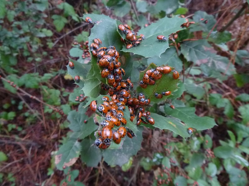
interpretative sign about the park's redwoods. When I was hiking here
once in February thousands of ladybugs (ladybird beetles) were spread
out among the understory foliage on the right side of the trail, and further
downtrail near the junction with Prince Road. They seemed to be hibernating.
It was an amazing site; all those beetles tucked against each other on
plant fronds and stems. From a distance they appeared to be a pile of
orange leaves. (Visit the Oddities
page for photos.) Stream Trail (on which bicycles are permitted
on the paved section downtrail, but not here) is a wide path that winds
through redwoods along the canyon floor and Redwood Creek. On the left
 side of the trail look uphill for a glimpse of a huge boulder field covered with green moss. Fences continue
to discourage access into the creek, which gives this section of the park
a bit of a Muir Woods feel, except that there aren't busloads of tourists
taking photos of scrub jays. At 2.3 miles, look for the start of Prince
Road to the left at a signed junction. Turn left onto Prince Road.
side of the trail look uphill for a glimpse of a huge boulder field covered with green moss. Fences continue
to discourage access into the creek, which gives this section of the park
a bit of a Muir Woods feel, except that there aren't busloads of tourists
taking photos of scrub jays. At 2.3 miles, look for the start of Prince
Road to the left at a signed junction. Turn left onto Prince Road.
Before you head uphill, you may opt to take a
break on a bench under the shade of madrones and a few walnut trees. After
a few miles of easy level and downhill hiking, Prince Road offers the
only real climb of the featured hike. The broad trail, open to equestrians
and hikers only, leaves the redwoods behind as it curves uphill under
the shade of California bay, coast live oak, and madrone. Look for the
red orchid coralroot in spring. Prince Road leaves the trees and ascends
through a mixture of grassland, coyote brush, blackberry, and poison oak.
Luckily the climb doesn't last long, and at 2.65 miles, the trail ends
at a signed junction with East Ridge Trail. Turn left onto East Ridge
Trail.
A few steps from the junction, off to the
side of this wide multi-use trail, there's a grassy spot with views to
the redwood covered hills to the west: a good choice for a rest break
or picnic. Look for bobcat, deer, and coyote prints on the trail, particularly evident
when the surface is a bit muddy. Madrone, coast live oak, coyote brush,
and pine line the trail. At a signed junction at 2.9 miles. East Ridge
Trail continues straight, and Phillips Loop Trail breaks off to the left.
Both trails are about the same length, with Phillips providing a few more
ups and downs on a trail running below the ridge line. Turn left onto
Phillips Loop Trail.
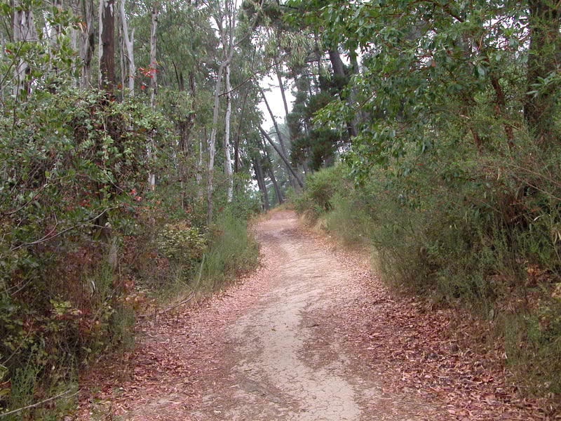
Pine, madrone, broom, coyote brush, and eucalyptus
line the path, which is closed to cyclists. When there's a break in the
foliage, look to the left for views of distant hills to the south. You
may hear hawk cries piercing the quiet skies. At 3.2 miles, Phillips
Loop Trail crosses Eucalyptus Trail at a signed junction. Continue
straight on Phillips Loop Trail.
The trail slightly wanders up and down,
through a mix of native and exotic plants. You might see poison oak (in
abundance) and toyon, as well as the purple flowers
of Ithuriel's spear and brodiaea in late May. Non-natives such as eucalyptus
and cotoneaster are common. Phillips Loop Trail ends at a signed junction
with East Ridge Trail at 3.9 miles. Turn left.
Just past the junction, on the right side
of the trail, the Bay Area Ridge Trail/East Bay Skyline National Recreation
Trail (the Skyline Trail is a 31-mile continuous course running from Wildcat
Canyon Park near Richmond to Anthony Chabot Park near Castro Valley) breaks
off at a signed junction, and heads north toward Huckleberry Regional
Botanic Preserve. Continue straight on East Ridge Trail. The broad
flat, multi-use trail sweeps around a hillside verdant in late winter,
but dry and choked with thistles by late spring. Every year during winter
storms, a few tall pine trees are uprooted by the wind; fallen comrades
sprawl downhill toward the canyon. East Ridge Trail offers up one last
view to the south, before ending at the parking lot.
Total distance: 4.1 miles
Last hiked: August 28, 2003
Previous visits: June 4, 2001 and February 4, 2000