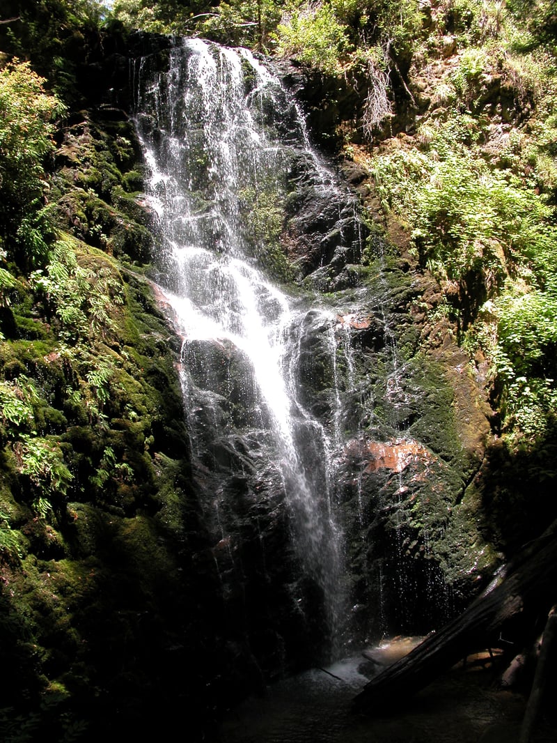
Nestled in California's
oldest state park, this popular hike begins at the Big Basin park headquarters, and follows undulating
Sunset Trail downhill through forested canyons to a series of three dramatic
waterfalls. The return leg, a segment of Skyline to the Sea Trail, rises
along murmuring creeks back to the trailhead.
Begin at the edge of the main parking lot, on signed Redwood Trail.
The wide flat path winds through redwoods. After about 400 feet, you'll reach a junction (bathrooms sit just off the trail to the right here). Contine straight on Skyline to the Sea Trail. A bridge crosses Opal Creek and at the end of it you'll reach a signed T junction. Turn right toward Dool and Sunset trails.
At a level grade, the broad trail runs
along Opal Creek, through the outskirts of the park headquarters area. A trail from a secondary parking lot enters from the right. Noise from vehicles and park visitors fades with each step through redwood,
huckleberry, and tanoak woods. After about 0.4 mile, Skyline to the Sea continues
to the north, on its way to Castle Rock State Park; turn left,
onto Dool Trail.
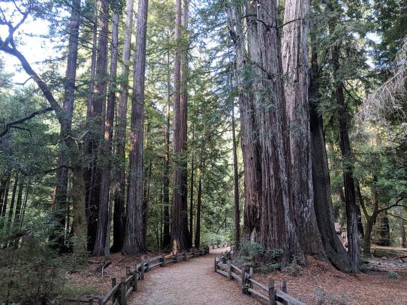 The trail rises easily through the forest,
then reaches a junction with Sunset Trail, at about 0.45 mile. Turn
left.
The trail rises easily through the forest,
then reaches a junction with Sunset Trail, at about 0.45 mile. Turn
left.
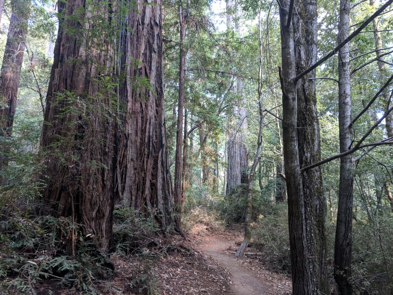
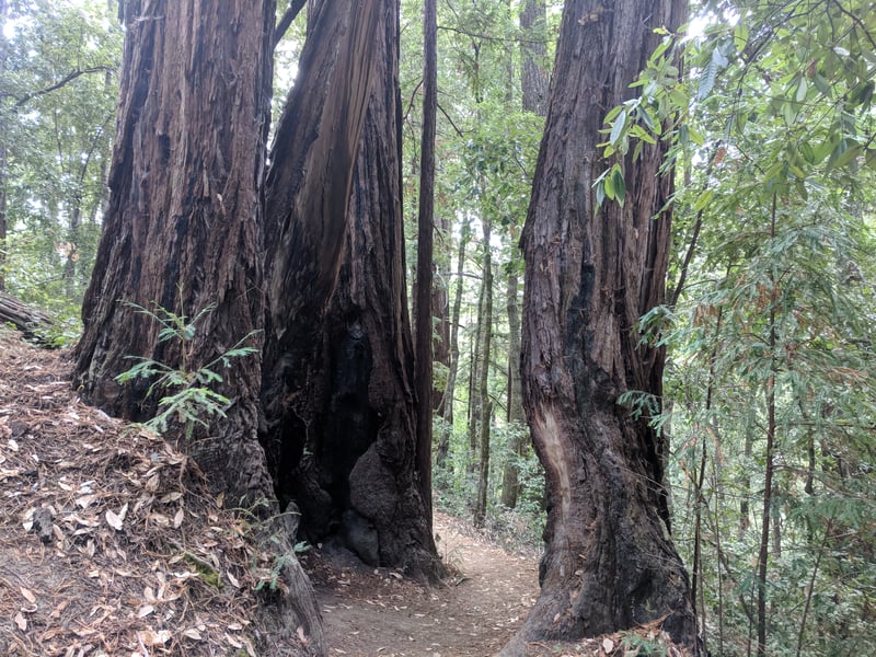
Sunset Trail begins to climb through tanoak, Douglar fir, and redwoods. Some of the trees along the trail are charred
by fire, and a few of the huge redwoods have burned-out trunks. Early settlers
confined poultry in these hollowed-out trees, which became known as "goose
pens." At 0.9 mile, Sunset Trail crests at the junction with Middle Ridge
Road. Continue across the fire road on Sunset Trail, which begins
an easy descent.
Winding down into a redwood canyon, you
might see milkwort and California harebell in summer, and in a short grassy
stretch, lingering blossoms of
Ithuriel's spear and vetch. At 1.1 miles a connector to Skyline to the
Sea departs on the left, but continue straight on Sunset Trail.
A few coast live oaks give way to a forest
dominated by redwood and tanoak. The trail ascends gently, crosses over
a knoll, and drops through woods where trilliums, redwood violets, western
hearts ease, and fairy lanterns bloom in spring. At West Waddell Creek,
a pretty stream graced with a few big-leaf maples, the trail rises again.
Timms Creek Trail begins at 3.2 miles, heading off to the left as Sunset
Trail makes a sharp turn right. Timms Creek Trail, which leads to Skyline
to the Sea Trail, is a good bail-out route for hikers who are ready to
return to the trailhead. Continue on Sunset Trail, climbing steadily
straight uphill.
Sunset Trail crests near a huge fallen
redwood, then begins to descend through very quiet woods. After crossing
 Berry Creek, the path ascends again, and soon steps out of the woods to
bisect a swale of chaparral. Manzanita covers the chalky white hillsides
to the left and right, and these low-slung evergreen shrubs, mixed through
occasional knobcone pines, permit views south to the forested canyon surrounding the waterfalls. Bush poppy's
cheerful yellow flowers stand out in a sea of green in early summer, preceding
chamise's bloom and fruit on huckleberry shrubs. As Sunset Trail leaves
the chaparral, live oaks, California nutmeg, and Douglas fir bridge the
transition back into redwood and tanoak. At 4.8 miles the trail to Sunset
Camp breaks off to the right -- continue straight, now on Berry Creek
Falls Trail.
Berry Creek, the path ascends again, and soon steps out of the woods to
bisect a swale of chaparral. Manzanita covers the chalky white hillsides
to the left and right, and these low-slung evergreen shrubs, mixed through
occasional knobcone pines, permit views south to the forested canyon surrounding the waterfalls. Bush poppy's
cheerful yellow flowers stand out in a sea of green in early summer, preceding
chamise's bloom and fruit on huckleberry shrubs. As Sunset Trail leaves
the chaparral, live oaks, California nutmeg, and Douglas fir bridge the
transition back into redwood and tanoak. At 4.8 miles the trail to Sunset
Camp breaks off to the right -- continue straight, now on Berry Creek
Falls Trail.
The sound of water rushing, then falling,
increases as the trail descends. Then, on the right, Golden Falls comes
into view. A short switchback drops the trail to the side of the fall,
where water slides down a sloping wall of tawny-colored sandstone. The
water rushes to a second, short drop, then pools at the top of Silver
Falls. As the water shoots straight down 50 feet in a single
gasp, the trail clings to the side of the cliff, descending rock stairs.The guidewire on the right is essential, and take special care when the
water flow is heavy, for the steps will be slippery. Berry Creek Falls
Trail reaches the base of Silver Falls and then levels out and follows
the creek. When the creek is low, you can jump across to the right and
walk a few feet to get a close look at the fall. This interlude between
waterfalls is my favorite spot on the hike -- West Berry Creek burbles
along the trail and sunlight filters through redwoods to an understory
of ferns, where starflower, trilliums, and redwood sorrel brighten the
forest floor in spring, and butterflies float through the air in summer.
Just past the confluence of West Berry and Berry creeks, the trail crosses
the stream and rises to overlook the top of Berry Creek Falls, a 60-foot
 drop distinguished by gorgeous ferns and moss covering the rocks around
the water flow. There are wonderful views to the falls as the trail descends
to a viewing platform near the base of the falls -- if it's not crowded,
this is an ideal location for lunch. Past the platform, the trail descends
to a junction at 5.8 miles. Turn left onto Skyline to the Sea Trail.
drop distinguished by gorgeous ferns and moss covering the rocks around
the water flow. There are wonderful views to the falls as the trail descends
to a viewing platform near the base of the falls -- if it's not crowded,
this is an ideal location for lunch. Past the platform, the trail descends
to a junction at 5.8 miles. Turn left onto Skyline to the Sea Trail.
A bridge crosses the confluence of Berry
and West Waddell creeks, then Skyline to the Sea Trail climbs somewhat
sharply to a bench where there is one last view to Berry Creek Falls.
I lunched here once and enjoyed the waterfall view and entertainment
provided by a band of marauding steller's jays, who perched on a nearby
fence hoping for breadcrumbs. Past the bench, Skyline to the Sea Trail
begins a rollicking course of short ups and downs, along West Waddell
Creek. Azaleas and big-leaf maples line the stream as the trail crosses
the water for the south bank, where you may notice salal and wild rose
in the understory of tanoak and redwood. Past some big boulders sitting
in the creekbed at 6.7 miles, Timms Creek Trail crosses the creek on the left, at the confluence of West Waddell and Kelly Creek. Continue
straight on Skyline to the Sea Trail, still climbing, here at a more
straightforward uphill pace.
The trail wanders through a beautiful redwood
forest where clintonia, a lily with magenta flowers, blooms in late spring.
Later, in summer, orchids unfurl, including the native reddish stripped
and spotted coralroots, and helleborine, with purple-green flowers, an
import from Eurasia. Skyline to the Sea Trail forks, with the left
leg crossing the creek-either path is an option, as they both reconnect
shortly.
Past the rejoining, Skyline to the Sea
Trail crosses Kelly Creek, then begins to climb out of the canyon, away
from the creek. The forest remains quiet and shaded, and you might see
banana slugs along the trail, particularly in cool, damp weather. At 8.3
miles the connector to Sunset Trail heads uphill to the left -- continue
straight on Skyline to the Sea Trail.
The ascent mellows as you reach the hike's
highest elevation, over 1,300 feet. Skyline to the Sea Trail crosses Middle
Ridge Fire Road at 8.8 miles, then descends through redwoods scarred by
fire. In spring, starflower and trilliums bloom along the path. At the 9.4-mile mark, bear left at a signed junction toward park headquarters.
After a short flat section, at 9.5 miles you'll reach the junction with the Skyline to the Sea split at Opal Creek; turn right and return to the trailhead.
Total distance: 9.6 miles
Last hiked: July 3, 2003