If you yearn for a real
getaway from city life, head to Henry Coe State
Park. Although Coe is a substantial drive from some parts of the Bay Area,
it offers superior day hikes as well as long multiday backpacking treks.
Henry Coe is California's second largest state
park, and with over 86,000 acres, there's plenty of room to roam. Part
of the Coast Range, the park is mostly comprised of steep-sided ridges
and creek-lined canyons, and sustains a variety of vegetation and terrific
spring wildflower displays. With so many trails, the choices are a bit
mind-boggling, and overzealous visitors often get in over their heads,
hiking too far in hot weather while carrying insufficient water. I recommend
the loop described below for first-timers. Hiking veterans can expand
 this trip to a 6.5-mile trek with significantly more elevation change
by substituting the Fish Trail for Flat Frog, then looping to Hobbs Road
via the Middle Ridge Trail.
this trip to a 6.5-mile trek with significantly more elevation change
by substituting the Fish Trail for Flat Frog, then looping to Hobbs Road
via the Middle Ridge Trail.
Begin from
the park headquarters on the well-signed Corral Trail, which sets
off at the edge of the parking lot, across from the visitor center. The
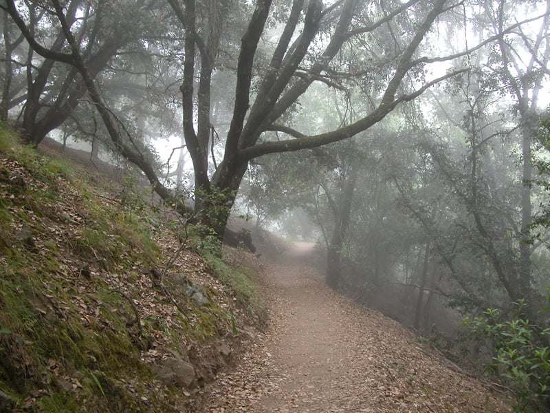
narrow trail descends to cross a damp area on a wooden bridge, then begins
a level journey on a ledge above a wooded gulch. On the morning of one
hike, cobwebs strung through trailside vegetation glistened with dew like
strands of sparking jewels. Buckeye, California bay, and live oaks shade
the trail most of the way, but in a few pockets chaparral shrubs chamise,
manzanita, and toyon bask on exposed hillsides. Like many of Coe's shaded
paths, Corral Trail hosts good displays of fairy lanterns in spring.
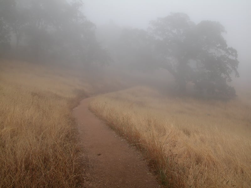
The trail finally leaves the woods for good and enters oak savanna, where
on a June hike thick fog obscured the landscape, and massive valley oaks
standing in grassland were reduced to ghostly figures looming in the distance.
Up close, disturbed vegetation under the oaks is an obvious sign of the
wild pig population inside the park -- pigs dig up the ground beneath oaks
while rooting for acorns. At half a mile, you'll reach a signed three-prong
junction. The trail to the right leads to Manzanita Point via Spring
Trail, and the path straight ahead, to Manzanita Point Road. Veer left
toward Flat Frog and Fish Trails.
After a few feet, the path crosses Manzanita
Point Road and reaches a junction with Flat Frog and Fish Trails. Bear
left onto Flat Frog.
 After hiking less than 30 minutes, there is virtually
no noise from the outside world -- except for occasional airplanes traveling
overhead, bird songs, quails chirping unseen in the brush, squirrels scampering
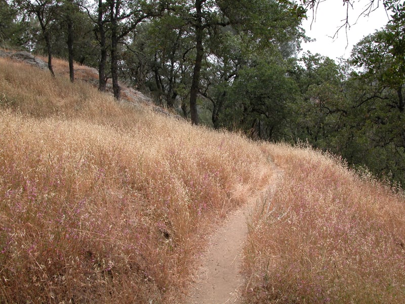
from tree to tree, and leaves whispering in the breeze make up the soundscape. Keeping an easy grade, this slight path follows a contour on the side
of the hill with a ravine to the right, winding through a sparse woodland
of pines, California bay, manzanita, and a variety of deciduous and evergreen
oaks. By mid-June, flowers on fairy lanterns are gone, leaving dangling
seed pods, while great washes of elegant clarkia stain the drying grass
pink. Occasionally, the trail bisects little huddles of chaparral, as
well as increasing amounts of poison oak and creambush, but overall the
vegetation is dominated by trees, including some big-leaf maple and madrone.
With displays of pink flowers, coyote mint is common in late spring. As
the ravine begins to open out, there are views across the canyon to another
ridge, and ceanothus, scrub oak, cercocarpus, and toyon make appearances.
Thickets of snowberry crowd Flat Frog Trail, which bends left to follow
a creek just before the trail ends at a multiple junction at 2.65 miles.
Hobbs Road heads uphill both to the left and right, and Frog Lake
Trail sets off for its namesake, sharply to the right. Turn left onto
Hobbs Road.
After hiking less than 30 minutes, there is virtually
no noise from the outside world -- except for occasional airplanes traveling
overhead, bird songs, quails chirping unseen in the brush, squirrels scampering
from tree to tree, and leaves whispering in the breeze make up the soundscape. Keeping an easy grade, this slight path follows a contour on the side
of the hill with a ravine to the right, winding through a sparse woodland
of pines, California bay, manzanita, and a variety of deciduous and evergreen
oaks. By mid-June, flowers on fairy lanterns are gone, leaving dangling
seed pods, while great washes of elegant clarkia stain the drying grass
pink. Occasionally, the trail bisects little huddles of chaparral, as
well as increasing amounts of poison oak and creambush, but overall the
vegetation is dominated by trees, including some big-leaf maple and madrone.
With displays of pink flowers, coyote mint is common in late spring. As
the ravine begins to open out, there are views across the canyon to another
ridge, and ceanothus, scrub oak, cercocarpus, and toyon make appearances.
Thickets of snowberry crowd Flat Frog Trail, which bends left to follow
a creek just before the trail ends at a multiple junction at 2.65 miles.
Hobbs Road heads uphill both to the left and right, and Frog Lake
Trail sets off for its namesake, sharply to the right. Turn left onto
Hobbs Road.
Ascending narrow Pine Ridge, a climb begins,
moderate at first but then increasingly sharp. Along the fire road there's
some California coffeeberry, pine, madrone, and oak above a grassy understory
where you might see milkweed and pink-tinted clay mariposa lilies in early
June. If you pause to look back downhill, Mount Hamilton's Lick Observatory
dome is prominent in the distance to the north. In a little dip, Monument
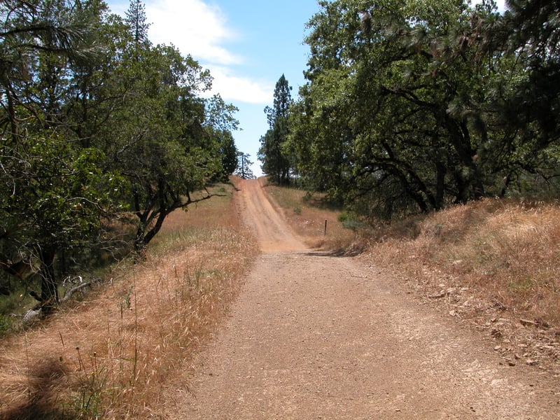 Trail departs to the right at 3.4 miles. Continue
straight on Hobbs Road, which soon crests at the flat ridge top. Just
as the fire road begins to descend, turn left across from a junction
with Ponderosa Trail at 3.5 miles.
Trail departs to the right at 3.4 miles. Continue
straight on Hobbs Road, which soon crests at the flat ridge top. Just
as the fire road begins to descend, turn left across from a junction
with Ponderosa Trail at 3.5 miles.
A short path leads to the Henry Coe monument,
a small headstone-like memorial with Coe's birth and death dates, as well
as the following inscription: "May these quiet hills bring peace to the
souls of those who are seeking." Coe and his family ranched this land
until his death in 1943. Shortly thereafter the land was sold, but Coe's
daughter Sada repurchased the property, then donated the 12,230-acre parcel
to Santa Clara County in 1953. Turn back to the fire road, then cross
it onto Ponderosa Trail.
This slight path can be hard to follow when the
grass is tall, but the obscure section is short. Ponderosa winds slightly
uphill through blue oaks and pine, then descends to a junction with
the Monument Trail at 3.65 miles. Continue straight, following the sign
to the vista point.
The path rises gently, then levels out in a broad,
grassy plateau, topped with a few big, mature ponderosa pine, blue oak,
and young madrone. In June, elegant brodaeia and yellow mariposa lily
bloom through the pure stands of thigh-high grass. Off in the distance
to the left (west), lower Santa Clara Valley is visible. At 3.85 miles
the paths split around Eric's Bench (the paths eventually rejoin at the
park boundary). This is a fantastic resting place for lunch or a water
break. If you proceed a bit farther down the left fork, you'll come to
an graceful blue oak, standing alone in the grass. When you're ready,
return to the junction with Monument Trail, and turn right.
Descending steadily, the small footpath sweeps
through grassland, then switchbacks through a pocket of California bay
and ends at 4.35 miles. Turn right onto Manzanita Point Road, where
a gate stretches across the fire road and dirt turns to pavement near
a house.
Manzanita Point Road descends gently toward park
headquarters, then ends at 4.45 miles. Veer left onto the park road,
and walk the remaining 100 feet back to the parking area.
Total distance: 4.5 miles
Last hiked: June 19, 2003