Stile
Ranch Trail traverses low hills near IBM's Almaden research property,
in the southwest corner of Santa Teresa County Park. This
1.4 mile footpath, which is also a Bay Area Ridge Trail segment, is a
particular favorite with native plant enthusiasts. Rocky soil along the
trail hosts a great variety of endemic and common western flowers
which bloom throughout spring.
Hikers can combine Stile Ranch Trail with
the county park's trail network for hikes clocking in at about 5 miles;
in addition to Stile Ranch Trail, folks out for flowers generally find
the best displays on Rocky Ridge and Bernal Hill Loop trails. Since Stile
 Ranch Trail and Santa Teresa County Park are connected, you can begin
hikes from the free, no-frills easement trailhead on San Vicente Road,
or from the county park's main area, complete with picnic facilities and restrooms (fee required).
Ranch Trail and Santa Teresa County Park are connected, you can begin
hikes from the free, no-frills easement trailhead on San Vicente Road,
or from the county park's main area, complete with picnic facilities and restrooms (fee required).
For this featured hike, begin at the Stile
Ranch trailhead, which is at the edge of a agricultural/semi-rural
area. Just past a big trail sign, you'll reach a signed junction. Turn
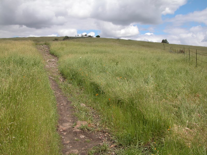
left, onto Stile Ranch Trail. The narrow, multi-use path climbs gently
on switchbacks, through dense thickets of black sage, sagebrush, and occasional
colonies of manzanita. In spring, look for California poppies, orange
fiddlenecks, bluedicks, popcorn flower, chia, and yarrow. After 0.3 mile,
the rocky trail drifts into grassland and the uphill grade slackens. Here
in spring, you may see California gilia, goldenfields, bluedicks, tidytips,
and jewelflower, a single-stalked plant with flowers that resemble little
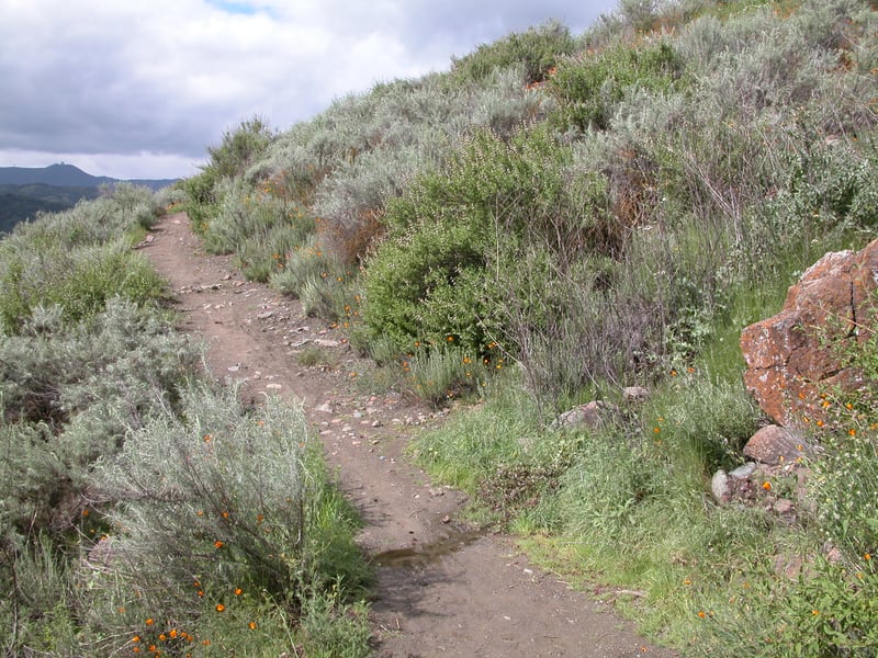
pink frilly-tipped pouches. Stile Ranch Trail passes through a gap in an old stone wall and ascends easily along the easement boundary, to the left. There are views from the trail
southeast to the hills of Santa Teresa, and back to the southwest, of
Mount Umunhum. After cresting at 0.7 mile, the trail begins to descend
through another area with good native flower displays in spring, including
more gilias, linanthus, onions, and claytonia. The IBM Almaden facility
is visible on the left as the trail turns and heads down the side of a
grassy gulch. A few California bay and scrub oak trees, and poison oak
and California coffeeberry bushes thrive here, and the next stretch of
trail leading down to a creek crossing can be very muddy following rainstorms.
Once across a footbridge, Stile Ranch Trail climbs back uphill to more
 dry ground, where on an early spring hike I saw several varieties of butterflies, including a
gorgeous Acmon blue. Some boulders studding the grassland are covered
with bright orange lichen, quite a color contrast to early spring's vibrant
green grass. Once more the trail descends, this time for good. Stile Ranch
Trail crosses another creek by a big valley oak, then follows the stream
into Santa Teresa County Park. At 1.5 miles Stile Ranch Trail ends at
a signed junction. Turn right onto Mine Trail.
dry ground, where on an early spring hike I saw several varieties of butterflies, including a
gorgeous Acmon blue. Some boulders studding the grassland are covered
with bright orange lichen, quite a color contrast to early spring's vibrant
green grass. Once more the trail descends, this time for good. Stile Ranch
Trail crosses another creek by a big valley oak, then follows the stream
into Santa Teresa County Park. At 1.5 miles Stile Ranch Trail ends at
a signed junction. Turn right onto Mine Trail.
The wide multi-use trail climbs slightly
through grassland. You may see or hear turkeys in this part of the park,
gobbling back and forth to each other, or trotting along the trails. Mine
Trail's ascent is brief, and soon you'll descend to a signed junction
at 1.7 miles. Turn right onto Fortini Trail.
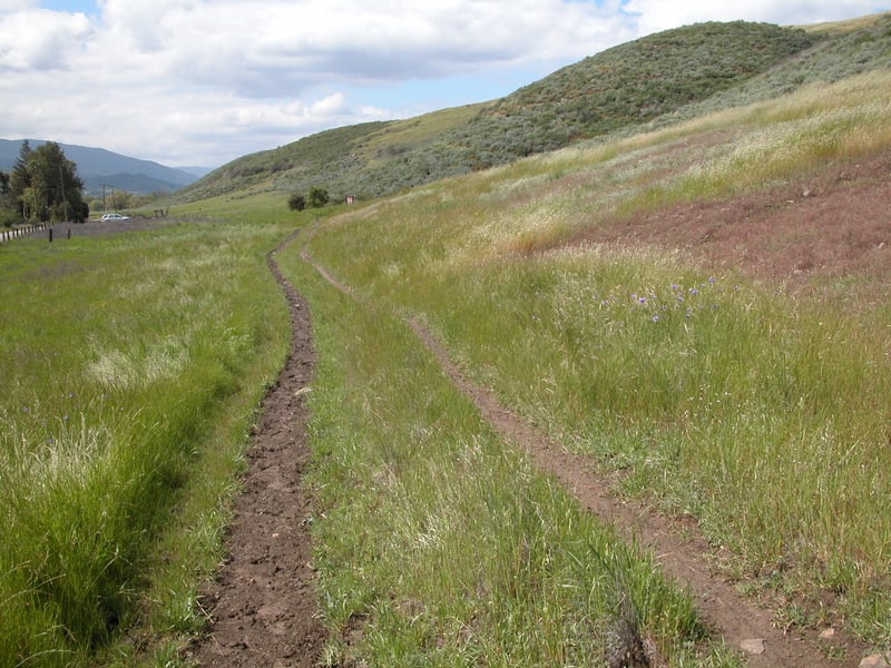
The broad trail, open to cyclists, equestrians,
and hikers, drops to meander along Santa Teresa Creek. After crossing
a stream feeding into the larger creek, Fortini Trail shrinks a bit. Expect more mud here
in late winter and early spring. At a nearly level pace, the trail sweeps
through grassland near the park boundary, to the left. Houses and horses
are both occasionally visible. Black sage, sagebrush, and a massive manzanita
stretch up the hillside on the right. On my March hike I saw quite a few
buckeye butterflies here. Now running parallel to a private road, Fortini
Trail continues to skirt a hill where jackrabbits hop about. Great clumps
of tidytips and bluedicks bloom along the trail in spring. At 2.5 miles,
Fortini Trail meets Stile Ranch Trail. Turn left and return to the
trailhead.
Total distance: 2.6 miles
Last hiked: Thursday, March 24, 2005