Monte
Bello (beautiful mountain), with
varied features, is an important link in the chain of protected open space
clustered off the top of the mid-Santa Cruz Mountains. It connects
Upper Stevens Creek County Park with Skyline
Ridge, Los Trancos, and Rancho
San Antonio Open Space Preserves, enabling many different long hike
combinations. Monte Bello boasts grassland, Douglas fir, live oak, and
California bay forests, a riparian corridor, great views, and a backpack
camp. The rare, limited camping option (by permit only) makes it possible
to take a multi-day hike from the Santa Clara Valley to the coast.
Spring, with its attendant wildflower bonanza,
 is a great time to visit, but the other seasons are charming as well. In winter Stevens Creek is a roaring stream, and in late summer and autumn
bigleaf maples and deciduous oaks put on a foliage display. The seasons
really seem to stretch here, and you might see blossoms on a currant bush
in the canyon,
blue-eyed grass near the trailhead, and great spreads of popcorn flower,
johnny-jump-ups, owl's clover, and bicolor lupine at the ridgetop.
is a great time to visit, but the other seasons are charming as well. In winter Stevens Creek is a roaring stream, and in late summer and autumn
bigleaf maples and deciduous oaks put on a foliage display. The seasons
really seem to stretch here, and you might see blossoms on a currant bush
in the canyon,
blue-eyed grass near the trailhead, and great spreads of popcorn flower,
johnny-jump-ups, owl's clover, and bicolor lupine at the ridgetop.
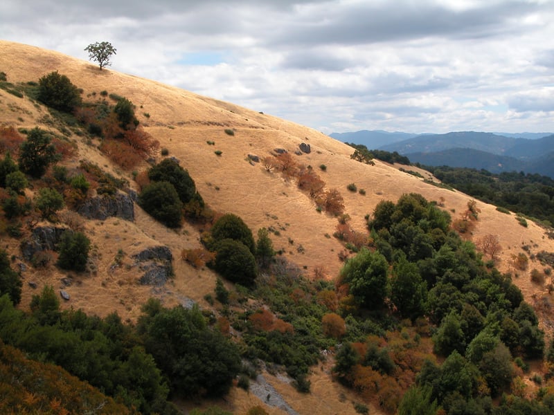
When it's hot this trek to
the top of Black Mountain may be too strenuous for beginning hikers. Canyon
Trail, a mostly gentle fire road, is popular with cyclists and follows
along Stevens Creek. Long loop hikes through adjacent preserves can be
created; refer to MROSD's South Skyline Region map for ideas. For
a shorter, easier loop, combine Stevens Creek Nature Trail with White
Oak Trail for a 3.7 mile hike.
This featured hike starts at
the edge of the parking lot on White Oak Trail. The narrow trail (which used to begin near Page Mill Road) follows the edge of grassland along the shoulder of the wooded canyon. Initially there are views south to Black Mountain, but soon the trees shade the path and block views. At the signed junction at 0.55 mile, stay to the left on White Oak Trail, which begins to descend.
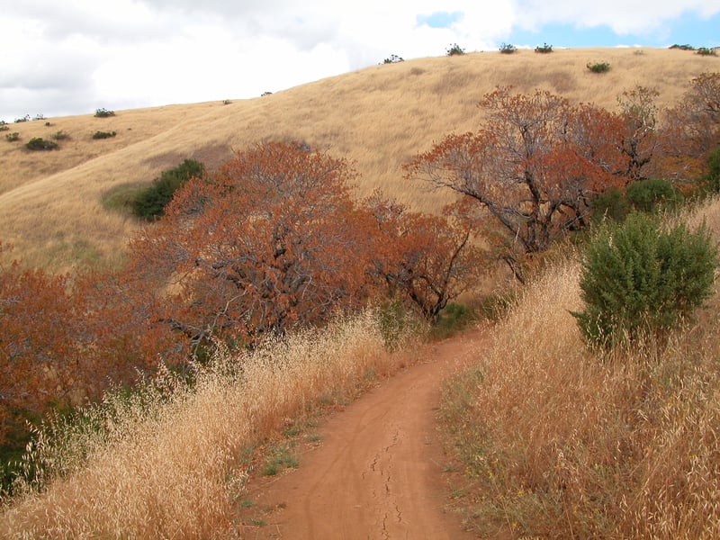
The trail passes through madrone and oak woods, then emerges into grassland peppered with huge old white oaks. Valley and Oregon oak are both classified as white oaks, but Oregon oaks are an unusual white oaks. Valley and Oregon oak are both classified as white oaks, but Oregon oaks are an unusual find in the South Bay. Some of these gorgeous oaks are Oregon oaks, but it takes a practiced eye to tell them apart -- oak leaves can vary from tree to tree, and the most telltale distinguishing feature, the acorn, is around for perusal only in autumn (valley oak acorns are slender and long, while Oregon oaks' are short and fat). Even though it's tough to identify them, it's easy to admire these venerable oaks.
A series of broad switchbacks marks a transition, and White
Oaks Trail begins an earnest descent into the canyon. On the way down, look for a few canyon live oaks (easy
to identify because the back of their leaves are golden colored). In spring,
mule ear sunflowers bask in the last stretches of sunny grassland. The
woods are a welcome relief on a hot day, if you can tolerate the biblical
proportion of insects that sometimes frequent the area. As you get
close to Stevens Creek and its tributaries, wild rose, gooseberry, ferns,
poison oak, and creambush occupy the understory of California bay, big
leaf maple, interior live oak, and tanoak. Currant shrubs linger at every
creek crossing. At 1.76 miles Skid Road Trail sets off to the right at
 a signed junction, connecting this preserve to Skyline Ridge. Turn
left, following the trail signs for Stevens Creek Nature Trail and Canyon
Trail.
a signed junction, connecting this preserve to Skyline Ridge. Turn
left, following the trail signs for Stevens Creek Nature Trail and Canyon
Trail.
This next portion of trail is closed to cyclists
and equestrians in the wet winter months, but be aware that some cyclists
still use the trail, especially in this downhill direction. The
broad trail descends at an easy grade, under cover of a dense forest of
California bay, madrone, oaks, and Douglas fir. At 2.0 miles White Oak
Trail ends at a signed junction with Stevens Creek Nature Trail. To
shorten this hike, take the trail left, but for this featured hike
continue straight.
Stevens Creek Nature Trail has informational
placards sprinkled along the trail in both directions, enlightening trail
users about animal tracks, the food chain, wildflowers, insects, and coyotes.
This next stretch runs along (and across, thanks to some bridges) the
creek, through deeply shaded woods. In spring, you may see western heart's
ease, trillium, and coltsfoot in bloom. Look for an abundance of
berries, including blackberry and thimbleberry, in July and August. A
bit later, elderberry trees contribute some pretty blueberry-colored globes.
In the wet winter months Stevens Creek rages (and you may encounter fallen
trees and washed out sections of trail), but in the summer it's usually
a mere trickle. At one bridge a sizable stream feeds into Stevens Creek;
on this hike this is the first of two occasions you'll encounter this
creek. The trail switchbacks easily up out of the riparian corridor through
Douglas fir and live oaks, and at 2.6 miles you'll reach a signed intersection
with Canyon Trail. Tall oaks stand above a patch of grassland where baby
 blue eyes bloom in spring. Turn right and head south on Canyon Trail.
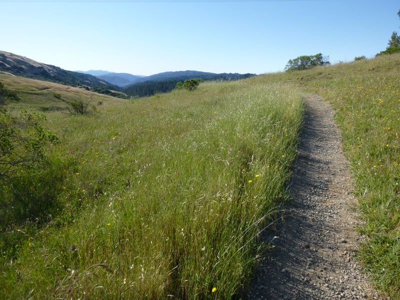
The broad multi-use trail weaves uphill,
through pockets of woods and stretches of grassland where there are views
uphill, left, to the ridge. In the grassy sections, look for popcorn flower,
blue-eyed grass, and checker-bloom in mid-April. At 2.85 miles, you'll
reach a signed junction with Indian Creek Trail. Turn left.
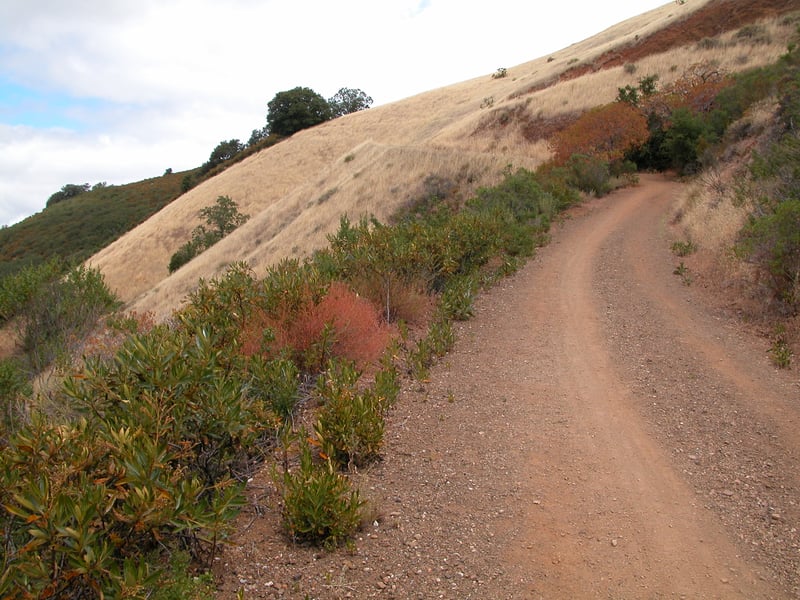
Indian Creek Trail, open to hikers,
cyclists, and equestrians, begins a moderately steep climb. At
first the wide trail is lined with madrone, oaks, and California bay,
but as the path ascends the vegetation shifts to poison oak, elderberry,
yerba santa, coyote brush, chamise, toyon, sagebrush, monkeyflower, and
coffeeberry. In spring you might see zigadene and mule ear sunflowers
on the ground, while clematis blossoms dangle from shrubs. Buckbrush flowers
will probably be dried up by mid-April, but that's when popcorn flowers,
fiddleneck, California poppy, bluedicks, owl's clover, and johnny-jump-ups
appear, with the displays intensifying as you ascend into grassland. There
are sweeping views south and west. At 3.9 miles, after climbing about
750 feet in the last mile, you'll reach a signed multiple junction.
(In you don't want to continue uphill to the summit, turn left, following the
signs to the backpack camp.) Continue uphill to the right.
Indian Creek Trail ascends gently, then ends at a signed junction with Monte
Bello Road at 4.12 miles. Bear right.
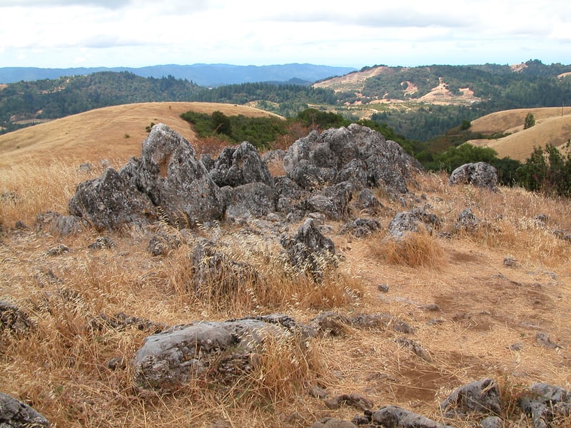
On this short push to the summit you'll pass the trail heading back down
into Rancho San Antonio Open Space Preserve on the left at 4.3 miles. Press on, and then arrive at
the Black Mountain summit. Spectacular views! The rocky area just off the trail is a great choice for
 a lunch break. When ready, retrace your steps back to the junction with Indian Creek Trail, at 4.61 miles. Bear
right, continuing on Monte Bello Road.
The wide trail descends to a junction at 4.7 miles. Bear left, toward the backpack camp.
You'll pass a connector heading back to Indian Creek Trail, then arrive at the camp (advance
reservations required!). Past the camp, the backpack trail ends at a multiple junction at 5 miles. Turn left onto Old Ranch Trail.
Almost immediately, an even
smaller path heads uphill to the right, marked with a "no
bikes/not a through trail" sign. Turn right onto this path.
a lunch break. When ready, retrace your steps back to the junction with Indian Creek Trail, at 4.61 miles. Bear
right, continuing on Monte Bello Road.
The wide trail descends to a junction at 4.7 miles. Bear left, toward the backpack camp.
You'll pass a connector heading back to Indian Creek Trail, then arrive at the camp (advance
reservations required!). Past the camp, the backpack trail ends at a multiple junction at 5 miles. Turn left onto Old Ranch Trail.
Almost immediately, an even
smaller path heads uphill to the right, marked with a "no
bikes/not a through trail" sign. Turn right onto this path.
The path ascends a few feet to a belvedere,
with great views in every direction, extending north all the way past
San Francisco to Mount Tamalpais. On an April hike, there were patches
of johnny-jump-ups, fiddlenecks, and popcorn flowers sprinkled throughout
the grass. When you're
ready, retrace your steps back to Old Ranch Trail, ignoring any
other unsanctioned trails. Turn right.
As it descends through grassland, the multi-use
trail keeps close to, but slightly downhill from the ridgeline.
In spring, bicolor lupines line the path, with smatterings of owl's clover,
and California poppy. Popcorn flowers and buttercups contribute
their white and yellow flowers to the mix as well. Old Ranch Trail curves past the top of a ravine, conspicuous with buckeyes and clusters
of poison oak. At 5.5 miles, you'll reach a signed junction. Stay
to the left, now on Bella Vista Trail.
Bella Vista Trail, open to hikers, equestrians,
and cyclists, continues downhill, to the west of the ridgeline. There
are long views north. Grassland still dominates, but as the trail descends you'll pass through a few damp sections in
the creases of the hillside, where buckeye, maple, oaks, and California
 bay thrive along displays of creambush. Here you'll pass over the
same stream you earlier watched empty into Stevens Creek. Look for red
flowers of California fuchsia blooming along the trail in August, and
assorted colorful butterflies including painted lady and common buckeye.
At 6.3 miles, Bella Vista Trail ends at a signed junction with Canyon
Trail. Turn right.
bay thrive along displays of creambush. Here you'll pass over the
same stream you earlier watched empty into Stevens Creek. Look for red
flowers of California fuchsia blooming along the trail in August, and
assorted colorful butterflies including painted lady and common buckeye.
At 6.3 miles, Bella Vista Trail ends at a signed junction with Canyon
Trail. Turn right.
Back on Canyon Trail, toyon,
coyote brush, and buckeye mark the transition into a hot but moist area.
Note a transitional sag pond sitting off the right side of the trail;
the San Andreas Fault runs through this preserve (to learn more about
earthquakes and this area, visit Los Trancos Open Space Preserve right across Page Mill Road). Continue straight past an unnamed path,
departing to the left, signed "no bikes/no horses." At a
signed junction at 6.5 miles, take the trail signed "to Monte Bello
Parking Lot" off the left side of the trail.
This lovely path, open to hikers only, cuts through
an old walnut orchard and reaches grassland where great views to the south
compete with scurrying lizards for your attention. A path feeds into the trail from the left
at 6.6 miles. To the west you should be able to pick out the upper portion
of Skid Road Trail you passed earlier, the cut visible across the valley.
Typically, around the last week in April there are luxuriant carpets of
owl's clover on a descending hillside to the left. At 6.8 miles, Stevens
Creek Nature Trail heads back down into the canyon at a signed junction
across from a stone bench. This is a welcome place to sit and watch hawks
fly over the grassland. Be sure to check out the placard identifying the
mountain panorama to the south. When it is clear, especially in winter,
Loma Prieta and Mount Umunhum seem quite close, just down the canyon to
the south. When you are ready, continue straight, back to the parking
lot.
Total distance: 6.9 miles
Last hiked: August 5, 2003
Previous visits: April 11, 2002 and August 15, 2000