Upper
Stevens Creek County Park is an important piece in the south skyline open space preserve and park region. The park connects Monte Bello, Long
Ridge, and Saratoga Gap open space preserves, and hosts a portion
of the Bay Area Ridge Trail. This connectivity benefits bicyclists the
most, as it enables them to string together trails and preserves to create
long, challenging loop rides. For hikers the only multi-preserve loop
is a 8.5 mile jaunt combining the Bay Area Ridge Trail, Charcoal Road,
Table Mountain Trail, Canyon Trail, Grizzly Flat Trail, Peters Creek Trail,
and Hickory Oaks Trail. This fairly strenuous hike drops down to the actual
Stevens Creek and then regains 1000 feet of elevation on the way back
to the trailhead, with a certain amount of roller coaster elevation changes
in between. Both the trailheads at Upper Stevens Creek County
Park afford access to Long Ridge Open Space Preserve. All
 hikes starting at Upper Stevens Creek County Park are the upside-down
variety (a descent followed by an ascent).
hikes starting at Upper Stevens Creek County Park are the upside-down
variety (a descent followed by an ascent).
I've enjoyed hikes here all year round.
In autumn black oaks, which blend in to the forest most of the year, pop
with color. Fall is also the season when poison oak is literally red-flagged
by nature; you'll be grateful for the warning along Alternate Trail, which
has a shocking amount of the noxious plant, some of it crowding the trail at an alarming face-height level. In winter Charcoal
Road is muddy, creeks swell with storm runoff, and manzanita bloom, but there
might be storm damage along Alternate Trail. Mid to late spring may be
my favorite, for that's the peak bloom of two of my favorite chaparral shrubs, bush poppy
and chaparral pea.<
Start this hike on the east
side of Skyline Boulevard, across the street from the Long Ridge Open
Space Preserve gate (LR01). Look for a narrow, unmarked path heading
east. After a few steps a small sign marks your entry into Upper
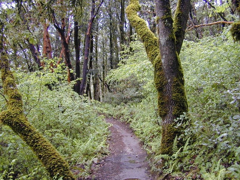
Stevens Creek County Park. The Bay Area Ridge
Trail segment winds slightly downhill through the shade of black oak, madrone,
California bay, and tanoak. Hazelnut is a common understory plant. At
0.3 mile, you'll reach a four way junction. Sandstone is the dominant
rock here, and this clearing is so deep with sand sometimes in summer
it's like a walk on the beach. Under the trees near the information signboard
are a few small Indian grinding bowls worn into a broad rock. Stop at
the information signboard here if you'd like to consult the map. Then take the broad trail to the left and downhill, Charcoal Road.
A trail signed hiking-only departs to the left
just a few feet down Charcoal Road; this is the path you'll take on the
return leg of this hike. Charcoal Road is signed for uphill bicycle traffic
only, which means you shouldn't have to check your back every 20 seconds
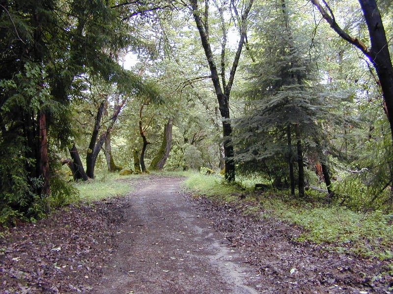 to make sure you won't be run over as you descend. Initially the descent
is slight, but soon the grade becomes sharp. The fire road features a
panoply of plants, including bigleaf maple, madrone, Douglas fir, chamise,
manzanita, coyote brush, black oak, coast live oak, canyon live oak, poison
oak, and California bay. Chaparral pea and bush poppy bloom in late
May, on the left side of the trail. In October, look for lovely red-berried
honeysuckle vines hanging down off the trees. Later, in November,
madrone berries dangle off their branches. Occasionally the vegetation
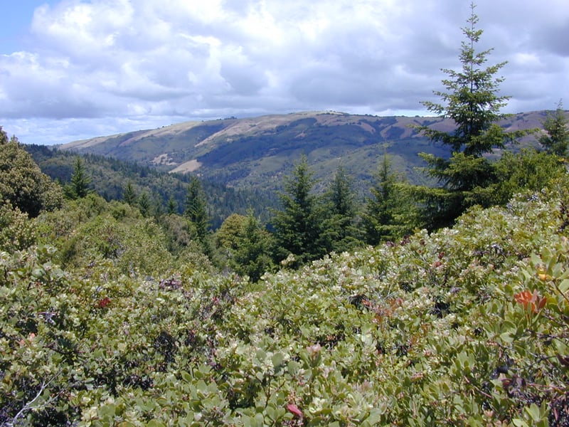
clears to offers views to the hills southeast, including Mount Hamilton and Mount Umunhum. The deeply dusty surface of the trail
makes for great animal tracking, particularly in the subsequent mud after
a rainstorm. Briefly Charcoal Road enters MROSD land. At 1.15 mile, stay
to the left at a signed junction with a service road.
to make sure you won't be run over as you descend. Initially the descent
is slight, but soon the grade becomes sharp. The fire road features a
panoply of plants, including bigleaf maple, madrone, Douglas fir, chamise,
manzanita, coyote brush, black oak, coast live oak, canyon live oak, poison
oak, and California bay. Chaparral pea and bush poppy bloom in late
May, on the left side of the trail. In October, look for lovely red-berried
honeysuckle vines hanging down off the trees. Later, in November,
madrone berries dangle off their branches. Occasionally the vegetation
clears to offers views to the hills southeast, including Mount Hamilton and Mount Umunhum. The deeply dusty surface of the trail
makes for great animal tracking, particularly in the subsequent mud after
a rainstorm. Briefly Charcoal Road enters MROSD land. At 1.15 mile, stay
to the left at a signed junction with a service road.
Charcoal Road narrows, and the jurisdiction returns
to Santa Clara County. Madrone, Douglas fir, coast live oak, and redwood
crowd the trail. At 1.8 miles, you'll reach an unsigned T junction.
Turn left (the trail to the right is not a through trail).
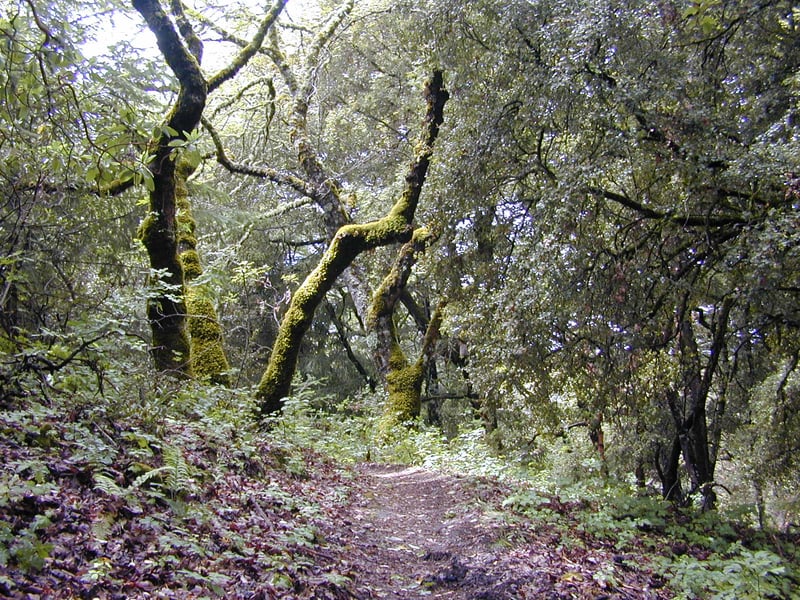
Now on Table Mountain Fire Road, the grade softens to a more moderate descent. Tree cover deepens, with a few redwoods accompanying a forest of Douglas fir and madrone. Eventually, the trail levels out, and you'll enter a clearing. This meadow is astonishingly quiet. Through the grassland an odd assortment of madrone, non-native conifers, coyote brush, California coffeeberry, and black and live oaks are sprinkled here and there. The views uphill to the rolling hills of Monte Bello Ridge
are pleasant. Somehow this meadow seems out-of-place in Santa Clara County. I
always feel like I'm in the Sierra, or some other place far from civilization. Stay
to the right at an unmarked junction at 2.05 miles, just past a pretty
perfectly-shaped conifer.
Wider here, Table Mountain Fire Road curves
around a gently sloping hill. Nonnative trees (firs) still can be glimpsed
on the sides of the trail, although there are huge piles of removed trees
clustered throughout the grass to the left. Oaks, Douglas fir, and madrones
are reclaiming their native soil. The trail sweeps back to the left, still
skirting the "summit" of Table Mountain, and reaches an unsigned
 junction at 2.7 miles, under the shade of some coast live oaks. The path
to the right descends to Stevens Creek. Continue straight on Table Mountain Fire Road . After a short straight stretch, a hiking-only trail sets out on the right side of the trail at 2.8 miles. Turn right.
junction at 2.7 miles, under the shade of some coast live oaks. The path
to the right descends to Stevens Creek. Continue straight on Table Mountain Fire Road . After a short straight stretch, a hiking-only trail sets out on the right side of the trail at 2.8 miles. Turn right.
On every one of my hikes it's
been apparent that the trail is used by cyclists. All along the length
of this trail, Santa Clara County Parks has tried to keep cyclists
off of the path, stretching logs across the trail, leaving fallen trees
partially obstructing the trail, and installing a fence-like shoot impossible
to navigate while on a bicycle. Nothing has worked. Bicyclists have
simply gone over, under, or around every obstacle. Be alert, for a collision
with bike descending this trail would be a serious incident. Also beware
of poison oak, which drifts toward the trail and hangs off trees (in winter
when the plant is leafless but still dangerous, treat every bare skinny
vine branch as a potential poison oak threat). It is really difficult to avoid some contact. I recommend wearing long pants and long sleeves, and taking a cool shower as soon as you get home. Aside from these caveats, it's a lovely long ascent, with no (legitimate) trail junctions the entire length of the trail. After drifting downhill through woods and some little meadows, Table Mountain Trail crosses a creek, and climbs through California bay, tanoak, coast live oak, canyon live oak, interior live
oak, hazelnut, Douglas fir, and madrone. You might also see creambush
and pitcher sage. A few early switchbacks lull you into the false confidence
that this will be a gently graded ascent. As you get further uphill, steeper
sections set you straight. Eventually the trail emerges into a clearing
of some chaparral, and for a while short stretches of open trail alternate
with more shady sections. Tall chaparral plants (manzanita, chaparral
pea, yerba santa, chamise, shrubby oaks, wartleaf ceanothus, golden fleece,
and coyote brush) sometimes tower over 6 feet tall, blocking most views.
At some clear spots, look south and east for the best views of the hike.
Table Mountain Trail heads back into the woods, still climbing at a moderate
grade. On the left you'll pass a trail, blocked off but still clearly
in use. The trail descends a bit. In autumn, beware of loose
rocks covered with fallen leaves on the trail surface. You might see California
nutmeg trees on the right side of the trail. At a sharp corner, a straight
channel reaches up to Charcoal Road (a path created by cyclists), while
the trail continues to the right. Table Mountain Trail ends shortly after,
at 5.2 miles, at a junction just before the large 4-way sandbox intersection. (This
trail is tough to spot when you're traveling north from the sandbox. If
you want to see a photo of the junction, click . It's
the small trail on the left by the reflective post.)
Take the Bay Area Ridge Trail to the right, retracing your steps back
to the trailhead.
Total distance: about 5.6 miles
Last hiked: May 21, 2002
Previous visits: October 19, 1999 and November 3, 2000